Catching-Illegal-Fishing
Using Global fishing watch's data to build a machine learning model that can identify illegal fishing and poaching activities through satellite and geo-location data.
Global fishing watch is a partnership between Google and Oceana to map all trackable fishing activity in world, in almost real time. This is a personal project using the data provided by global fishing watch.
The data provided has vessel ids, types and coordinates of encountered vessels.
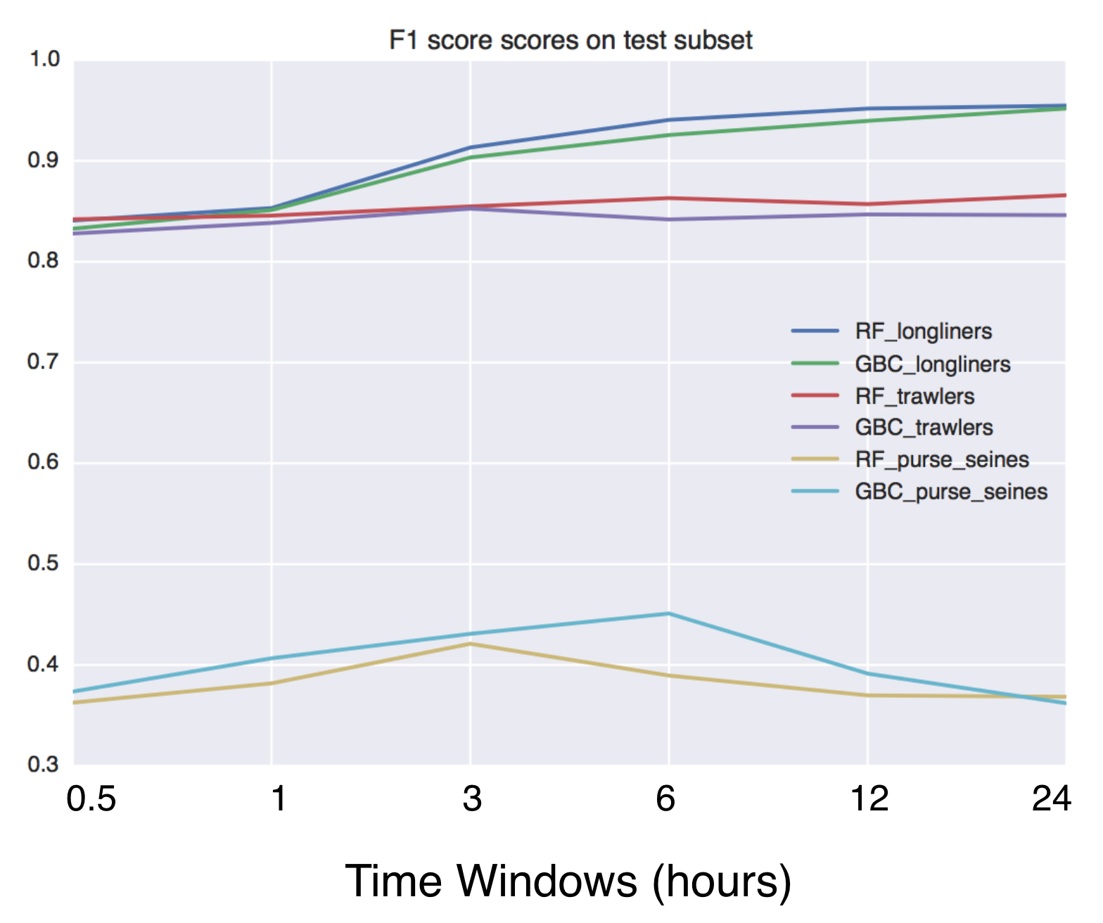
Given same vessel type and are, a fishing vessel has a different trajectory than a non fishing vessel. I used the data provided to train my model on predicting whether a vessel is fishing or not.
#Local Environment Setup Python 3.7++ Tensorflow version >1.14.0,<2.0 from (https://www.tensorflow.org/get_started/os_setup) pip install google-api-python-client pyyaml pytz newlinejson python-dateutil yattag
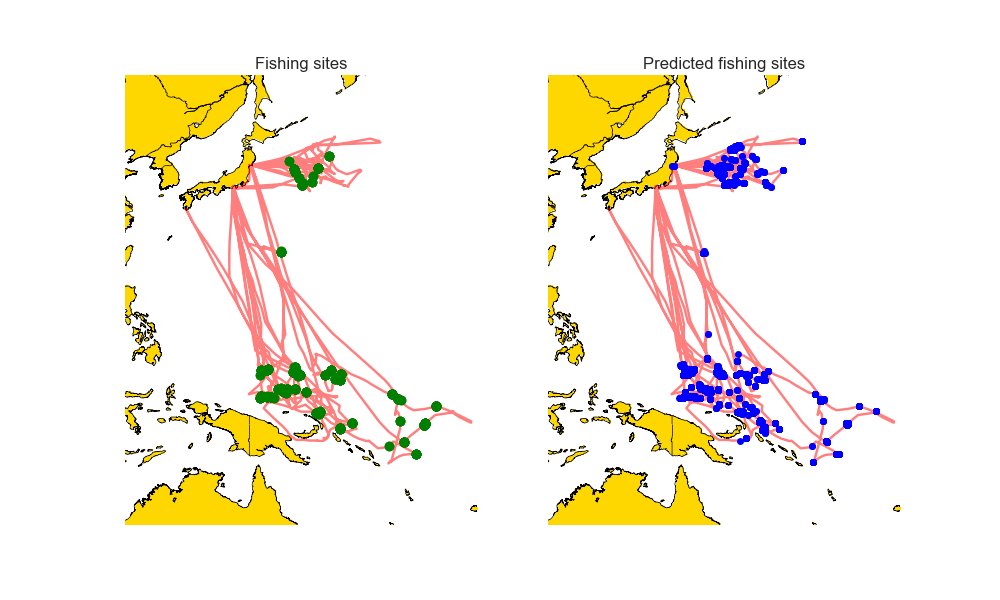
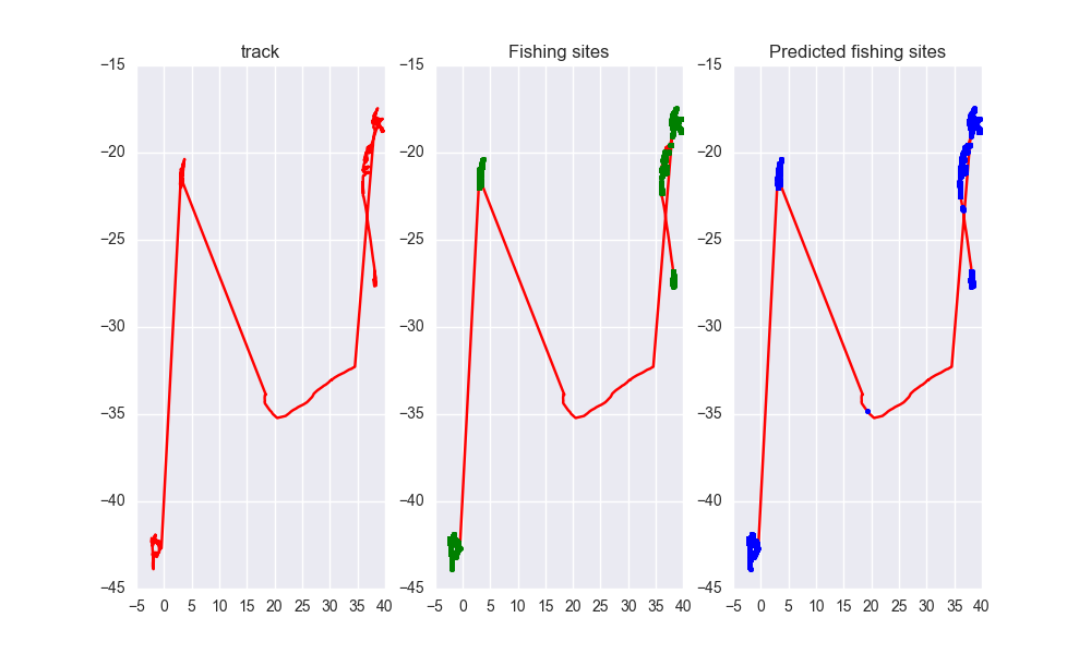
As you can see the predicted tracks are extremely close to the real paths.


