126 Repositories
Python map-prepare Libraries

This is the official repo for TransFill: Reference-guided Image Inpainting by Merging Multiple Color and Spatial Transformations at CVPR'21. According to some product reasons, we are not planning to release the training/testing codes and models. However, we will release the dataset and the scripts to prepare the dataset.
TransFill-Reference-Inpainting This is the official repo for TransFill: Reference-guided Image Inpainting by Merging Multiple Color and Spatial Transf

A large dataset of 100k Google Satellite and matching Map images, resembling pix2pix's Google Maps dataset.
Larger Google Sat2Map dataset This dataset extends the aerial ⟷ Maps dataset used in pix2pix (Isola et al., CVPR17). The provide script download_sat2m

Attention mechanism with MNIST dataset
[TensorFlow] Attention mechanism with MNIST dataset Usage $ python run.py Result Training Loss graph. Test Each figure shows input digit, attention ma

This is the antenna performance plotted from tinyGS reception data.
tinyGS-antenna-map This is the antenna performance plotted from tinyGS reception data. See their repository. The code produces a plot that provides Az
A neuroanatomy-based augmented reality experience powered by computer vision. Features 3D visuals of the Atlas Brain Map slices.
Brain Augmented Reality (AR) A neuroanatomy-based augmented reality experience powered by computer vision that features 3D visuals of the Atlas Brain
Automatically prepare your Minecraft maps for release
map-prepare Automatically prepare Mineraft map for release. Current state: kinda works Make sure you have backups for your world before running this p

A tool for making map images from OpenTTD save games
OpenTTD Surveyor A tool for making map images from OpenTTD save games. This is not part of the main OpenTTD codebase, nor is it ever intended to be pa
This is code to fit per-pixel environment map with spherical Gaussian lobes, using LBFGS optimization
Spherical Gaussian Optimization This is code to fit per-pixel environment map with spherical Gaussian lobes, using LBFGS optimization. This code has b
Audio processor to map oracle notes in the VoG raid in Destiny 2 to call outs.
vog_oracles Audio processor to map oracle notes in the VoG raid in Destiny 2 to call outs. Huge thanks to mzucker on GitHub for the note detection cod
An Artificial Intelligence trying to drive a car by itself on a user created map
An Artificial Intelligence trying to drive a car by itself on a user created map

Drone-based Joint Density Map Estimation, Localization and Tracking with Space-Time Multi-Scale Attention Network
DroneCrowd Paper Detection, Tracking, and Counting Meets Drones in Crowds: A Benchmark. Introduction This paper proposes a space-time multi-scale atte
Deep Compression for Dense Point Cloud Maps.
DEPOCO This repository implements the algorithms described in our paper Deep Compression for Dense Point Cloud Maps. How to get started (using Docker)

Predicting Semantic Map Representations from Images with Pyramid Occupancy Networks
This is the code associated with the paper Predicting Semantic Map Representations from Images with Pyramid Occupancy Networks, published at CVPR 2020.

The Django Leaflet Admin List package provides an admin list view featured by the map and bounding box filter for the geo-based data of the GeoDjango.
The Django Leaflet Admin List package provides an admin list view featured by the map and bounding box filter for the geo-based data of the GeoDjango. It requires a django-leaflet package.
basemap - Plot on map projections (with coastlines and political boundaries) using matplotlib.
Basemap Plot on map projections (with coastlines and political boundaries) using matplotlib. ⚠️ Warning: this package is being deprecated in favour of
Construct and use map tile grids in different projection.
Morecantile +-------------+-------------+ ymax | | | | x: 0 | x: 1 | | y: 0 | y: 0

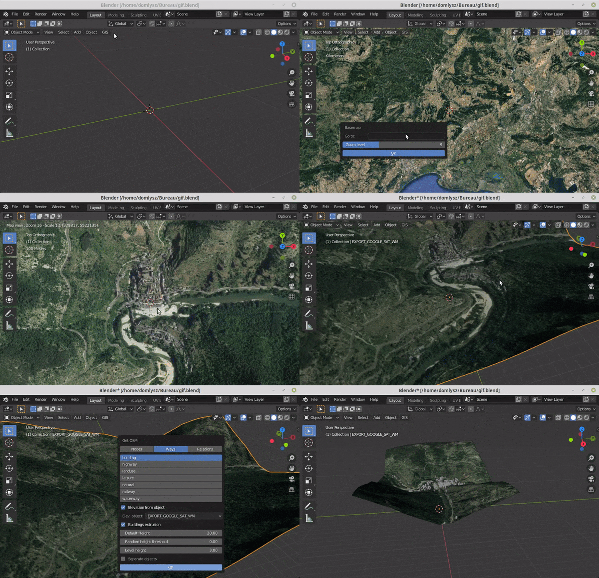
Blender addons to make the bridge between Blender and geographic data
Blender GIS Blender minimal version : 2.8 Mac users warning : currently the addon does not work on Mac with Blender 2.80 to 2.82. Please do not report

User friendly Rasterio plugin to read raster datasets.
rio-tiler User friendly Rasterio plugin to read raster datasets. Documentation: https://cogeotiff.github.io/rio-tiler/ Source Code: https://github.com

Solving the Traveling Salesman Problem using Self-Organizing Maps
Solving the Traveling Salesman Problem using Self-Organizing Maps This repository contains an implementation of a Self Organizing Map that can be used
Cloud-optimized, single-file archive format for pyramids of map tiles
PMTiles PMTiles is a single-file archive format for tiled data. A PMTiles archive can be hosted on a commodity storage platform such as S3, and enable
基于python爬虫爬取COVID-19爆发开始至今全球疫情数据并利用Echarts对数据进行分析与多样化展示。
COVID-19-Epidemic-Map 基于python爬虫爬取COVID-19爆发开始至今全球疫情数据并利用Echarts对数据进行分析与多样化展示。 觉得项目还不错的话欢迎给一个star! 项目的源码可以正常运行,各个库的版本、数据库的建表语句、运行过程中遇到的坑以及解决方式在笔记.md中都
uMap lets you create maps with OpenStreetMap layers in a minute and embed them in your site.
uMap project About uMap lets you create maps with OpenStreetMap layers in a minute and embed them in your site. Because we think that the more OSM wil
PubMed Mapper: A Python library that map PubMed XML to Python object
pubmed-mapper: A Python Library that map PubMed XML to Python object 中文文档 1. Philosophy view UML Programmatically access PubMed article is a common ta

Image morphing without reference points by applying warp maps and optimizing over them.
Differentiable Morphing Image morphing without reference points by applying warp maps and optimizing over them. Differentiable Morphing is machine lea
A Python Library for Self Organizing Map (SOM)
SOMPY A Python Library for Self Organizing Map (SOM) As much as possible, the structure of SOM is similar to somtoolbox in Matlab. It has the followin

StellarGraph - Machine Learning on Graphs
StellarGraph Machine Learning Library StellarGraph is a Python library for machine learning on graphs and networks. Table of Contents Introduction Get