140 Repositories
Python map-equation Libraries

📦 PyTorch based visualization package for generating layer-wise explanations for CNNs.
Explainable CNNs 📦 Flexible visualization package for generating layer-wise explanations for CNNs. It is a common notion that a Deep Learning model i

Cross-view Transformers for real-time Map-view Semantic Segmentation (CVPR 2022 Oral)
Cross View Transformers This repository contains the source code and data for our paper: Cross-view Transformers for real-time Map-view Semantic Segme

An attempt to map the areas with active conflict in Ukraine using open source twitter data.
Live Action Map (LAM) An attempt to use open source data on Twitter to map areas with active conflict. Right now it is used for the Ukraine-Russia con

A tool for generating skill map/tree like diagram
skillmap A tool for generating skill map/tree like diagram. What is a skill map/tree? Skill tree is a term used in video games, and it can be used for

Contrastive learning of Class-agnostic Activation Map for Weakly Supervised Object Localization and Semantic Segmentation (CVPR 2022)
CCAM (Unsupervised) Code repository for our paper "CCAM: Contrastive learning of Class-agnostic Activation Map for Weakly Supervised Object Localizati

Bot SpaceCrypto - An automation (bot) to play the game SpaceCrypto, it automatically log in, send ships to fight, refresh the game, new map, etc
SpaceCrypto Bot [en-us] In order to change to english Readme version click here.
GenshinMapAutoMarkTools - Tools To add/delete/refresh resources mark in Genshin Impact Map
使用说明 适配 windows7以上 64位 原神1920x1080窗口(其他分辨率后续适配) 待更新渊下宫 English version is to be
PINN Burgers - 1D Burgers equation simulated by PINN
PINN(s): Physics-Informed Neural Network(s) for Burgers equation This is an impl
Numerical differential equation solvers in JAX. Autodifferentiable and GPU-capable.
Diffrax Numerical differential equation solvers in JAX. Autodifferentiable and GPU-capable. Diffrax is a JAX-based library providing numerical differe
Map Ookla server locations as a Kernel Density Estimation (KDE) geographic map plot.
Ookla Server KDE Plotting This notebook was created to map Ookla server locations as a Kernel Density Estimation (KDE) geographic map plot. Currently,

Implementation of SOMs (Self-Organizing Maps) with neighborhood-based map topologies.
py-self-organizing-maps Simple implementation of self-organizing maps (SOMs) A SOM is an unsupervised method for learning a mapping from a discrete ne
Project aims to map out common user behavior on the computer
User-Behavior-Mapping-Tool Project aims to map out common user behavior on the computer. Most of the code is based on the research by kacos2000 found

This program analizes films database with adresses, and creates a folium map with closest films to the coordinates
Films-map-project UCU CS lab 1.2, 1st year This program analizes films database with adresses, and creates a folium map with closest films to the coor

Simple implementation of Self Organizing Maps (SOMs) with rectangular and hexagonal grid topologies
py-self-organizing-map Simple implementation of Self Organizing Maps (SOMs) with rectangular and hexagonal grid topologies. A SOM is a simple unsuperv
Source code for the paper "Periodic Traveling Waves in an Integro-Difference Equation With Non-Monotonic Growth and Strong Allee Effect"
Source code for the paper "Periodic Traveling Waves in an Integro-Difference Equation With Non-Monotonic Growth and Strong Allee Effect" by Michael Ne
Official implementation of NeuralFusion: Online Depth Map Fusion in Latent Space
NeuralFusion This is the official implementation of NeuralFusion: Online Depth Map Fusion in Latent Space. We provide code to train the proposed pipel

Using A * search algorithm and GBFS search algorithm to solve the Romanian problem
Romanian-problem-using-Astar-and-GBFS Using A * search algorithm and GBFS search algorithm to solve the Romanian problem Romanian problem: The agent i
Python project that aims to discover CDP neighbors and map their Layer-2 topology within a shareable medium like Visio or Draw.io.
Python project that aims to discover CDP neighbors and map their Layer-2 topology within a shareable medium like Visio or Draw.io.
Map Reduce Wordcount in Python using gRPC
This project is implemented in Python using gRPC. The input files are given in .txt format and the word count operation is performed.
A Python command-line utility for validating that the outputs of a given Declarative Form Azure Portal UI JSON template map to the input parameters of a given ARM Deployment Template JSON template
A Python command-line utility for validating that the outputs of a given Declarative Form Azure Portal UI JSON template map to the input parameters of a given ARM Deployment Template JSON template
Proyecto - Análisis de texto de eventos históricos
Acceder al código desde Google Colab para poder ver de manera adecuada todas las visualizaciones y poder interactuar con ellas. Link de acceso: https:
This repository contains the implementation of the following paper: Cross-Descriptor Visual Localization and Mapping
Cross-Descriptor Visual Localization and Mapping This repository contains the implementation of the following paper: "Cross-Descriptor Visual Localiza

Orchestrating Distributed Materials Acceleration Platform Tutorial
Orchestrating Distributed Materials Acceleration Platform Tutorial This tutorial for orchestrating distributed materials acceleration platform was pre
Computer Vision is an elective course of MSAI, SCSE, NTU, Singapore
[AI6122] Computer Vision is an elective course of MSAI, SCSE, NTU, Singapore. The repository corresponds to the AI6122 of Semester 1, AY2021-2022, starting from 08/2021. The instructor of this course is Prof. Lu Shijian.
Spectrum Surveying: Active Radio Map Estimation with Autonomous UAVs
Spectrum Surveying: The Python code in this repository implements the simulations and plots the figures described in the paper “Spectrum Surveying: Ac
Cweqgen - The CW Equation Generator
The CW Equation Generator The cweqgen (pronouced like "Queck-Jen") package provi
Map Matching & Weight Completion service - Java (Springboot) & Python(Flask)
Map Matching service to match coordinates to roads using Java and Springboot. Weight Completion service to fill in missing weights in a graph, using Python and Flask.

Python project to generate Kerala's distrcit level panchayath map.
Kerala-Panchayath-Maps Python project to generate Kerala's distrcit level panchayath map. As of now, geojson files of Kollam and Kozhikode are added t
Generates a clean .txt file of contents of a 3 lined csv file
Generates a clean .txt file of contents of a 3 lined csv file. File contents is the .gml file of some function which stores the contents of the csv as a map.
Defocus Map Estimation and Deblurring from a Single Dual-Pixel Image
Defocus Map Estimation and Deblurring from a Single Dual-Pixel Image This repository is an implementation of the method described in the following pap

RetinaNet-PyTorch - A RetinaNet Pytorch Implementation on remote sensing images and has the similar mAP result with RetinaNet in MMdetection
🚀 RetinaNet Horizontal Detector Based PyTorch This is a horizontal detector Ret
VCM EE1.2 P-layer feature map anchor generation 137th MPEG-VCM
VCM EE1.2 P-layer feature map anchor generation 137th MPEG-VCM

NasirKhusraw - The TSP solved using genetic algorithm and show TSP path overlaid on a map of the Iran provinces & their capitals.
Nasir Khusraw : Travelling Salesman Problem The TSP solved using genetic algorithm. This project show TSP path overlaid on a map of the Iran provinces
Saliency - Framework-agnostic implementation for state-of-the-art saliency methods (XRAI, BlurIG, SmoothGrad, and more).
Saliency Methods 🔴 Now framework-agnostic! (Example core notebook) 🔴 🔗 For further explanation of the methods and more examples of the resulting ma
Cvdl-hw2 - Find Contour, Camera Calibration, Augmented Reality and Stereo Disparity Map
opevcvdl-hw2 This project uses openCV and Qt to achieve the requirements. Version Python 3.7 opencv-contrib-python 3.4.2.17 Matplotlib 3.1.1 pyqt5 5.1
This program can calculate the Aerial Distance between two cities.
Aerial_Distance_Calculator This program can calculate the Aerial Distance between two cities. This repository include both Jupyter notebook and Python

Finite difference solution of 2D Poisson equation. Can handle Dirichlet, Neumann and mixed boundary conditions.
Poisson-solver-2D Finite difference solution of 2D Poisson equation Current version can handle Dirichlet, Neumann, and mixed (combination of Dirichlet

Time series visualizer is a flexible extension that provides filling world map by country from real data.
Time-series-visualizer Time series visualizer is a flexible extension that provides filling world map by country from csv or json file. You can know d
Male' Map Telegram Bot
Male' Map TelegramBot A simple TelegramBot to fetch residential addresses in Male', Maldives. The bot can be queried inline or directly. sample .env f

An HTML interface for finetuning the sync map output from aeneas
finetuneas 3.0 finetuneas is a simple HTML interface for fine tuning sync maps output by aeneas Version 3.0 Easier adjusting time: following cells wil
RCD: Relation Map Driven Cognitive Diagnosis for Intelligent Education Systems
RCD: Relation Map Driven Cognitive Diagnosis for Intelligent Education Systems This is our implementation for the paper: Weibo Gao, Qi Liu*, Zhenya Hu

An end-to-end image translation model with weight-map for color constancy
CCUnet An end-to-end image translation model with weight-map for color constancy 1. Download the dataset (take Colorchecker_recommended dataset as an

Robotics with GPU computing
Robotics with GPU computing Cupoch is a library that implements rapid 3D data processing for robotics using CUDA. The goal of this library is to imple

Computational Methods Course at UdeA. Forked and size reduced from:
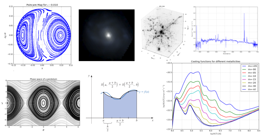
Computational Methods for Physics & Astronomy Book version at: https://restrepo.github.io/ComputationalMethods by: Sebastian Bustamante 2014/2015 Dieg
Simulation and Parameter Estimation in Geophysics
Simulation and Parameter Estimation in Geophysics - A python package for simulation and gradient based parameter estimation in the context of geophysical applications.

Python renderer for OpenStreetMap with custom icons intended to display as many map features as possible
Map Machine project consists of Python OpenStreetMap renderer: SVG map generation, SVG and PNG tile generation, Röntgen icon set: unique CC-BY 4.0 map

A python package simulating the quasi-2D pseudospin-1/2 Gross-Pitaevskii equation with NVIDIA GPU acceleration.
A python package simulating the quasi-2D pseudospin-1/2 Gross-Pitaevskii equation with NVIDIA GPU acceleration. Introduction spinor-gpe is high-level,

An open source bike computer based on Raspberry Pi Zero (W, WH) with GPS and ANT+. Including offline map and navigation.
Pi Zero Bikecomputer An open-source bike computer based on Raspberry Pi Zero (W, WH) with GPS and ANT+ https://github.com/hishizuka/pizero_bikecompute
This app is to use algorithms to find the root of the equation
In this repository, I made an amazing app with tkinter python language and other libraries the idea of this app is to use algorithms to find the root of the equation I used three methods from numerical analysis method that find the root and I made property draw function that draws almost any equation

Easy way to add GoogleMaps to Flask applications. maintainer: @getcake
Flask Google Maps Easy to use Google Maps in your Flask application requires Jinja Flask A google api key get here Contribute To contribute with the p

Explainability of the Implications of Supervised and Unsupervised Face Image Quality Estimations Through Activation Map Variation Analyses in Face Recognition Models
Explainable_FIQA_WITH_AMVA Note This is the official repository of the paper: Explainability of the Implications of Supervised and Unsupervised Face I
HDMapNet: A Local Semantic Map Learning and Evaluation Framework
HDMapNet_devkit Devkit for HDMapNet. HDMapNet: A Local Semantic Map Learning and Evaluation Framework Qi Li, Yue Wang, Yilun Wang, Hang Zhao [Paper] [

Script to create an animated data visualisation for categorical timeseries data - GIF choropleth map with annotations.
choropleth_ldn Simple script to create a chloropleth map of London with categorical timeseries data. The script in main.py creates a gif of the most f
This repository contains the map content ontology used in narrative cartography
Narrative-cartography-ontology This repository contains the map content ontology used in narrative cartography, which is associated with a submission
The venturimeter works on the principle of Bernoulli's equation, i.e., the pressure decreases as the velocity increases.
The venturimeter works on the principle of Bernoulli's equation, i.e., the pressure decreases as the velocity increases. The cross-section of the throat is less than the cross-section of the inlet pipe.The animation is done in python manim

Imperial Valley Geomorphology Map
Roughly maps the extent of basins, basin edges, and mountains in the Imperial Valley by grouping terrain classes from the Iwahashi et al. 2021 California terrian classification model.

A small collection of tools made by me, that you can use to visualize atomic orbitals in both 2D and 3D in different aspects.
Orbitals in Python A small collection of tools made by me, that you can use to visualize atomic orbitals in both 2D and 3D in different aspects, and o

PyTorch implementation of saliency map-aided GAN for Auto-demosaic+denosing
Saiency Map-aided GAN for RAW2RGB Mapping The PyTorch implementations and guideline for Saiency Map-aided GAN for RAW2RGB Mapping. 1 Implementations B
Infomap is a network clustering algorithm based on the Map equation.
Infomap Infomap is a network clustering algorithm based on the Map equation. For detailed documentation, see mapequation.org/infomap. For a list of re

SalGAN: Visual Saliency Prediction with Generative Adversarial Networks
SalGAN: Visual Saliency Prediction with Adversarial Networks Junting Pan Cristian Canton Ferrer Kevin McGuinness Noel O'Connor Jordi Torres Elisa Sayr
Self Organising Map (SOM) for clustering of atomistic samples through unsupervised learning.
Self Organising Map for Clustering of Atomistic Samples - V2 Description Self Organising Map (also known as Kohonen Network) implemented in Python for
A bot that tweets info and location map for new bicycle parking added to OpenStreetMap within a GeoJSON boundary.
Bike parking tweepy bot app A twitter bot app that searches for bicycle parking added to OpenStreetMap. Relies on AWS Lambda/S3, Python3, Tweepy, Flas

MiniSom is a minimalistic implementation of the Self Organizing Maps
MiniSom Self Organizing Maps MiniSom is a minimalistic and Numpy based implementation of the Self Organizing Maps (SOM). SOM is a type of Artificial N
Implementation of Monocular Direct Sparse Localization in a Prior 3D Surfel Map (DSL)
DSL Project page: https://sites.google.com/view/dsl-ram-lab/ Monocular Direct Sparse Localization in a Prior 3D Surfel Map Authors: Haoyang Ye, Huaiya

A trivia questions about Europe
EUROPE TRIVIA QUIZ IN PYTHON Project Outline Ask user if he / she knows more about Europe. If yes show the Trivia main screen, else show the end Trivi

Learning to Map Large-scale Sparse Graphs on Memristive Crossbar
Release of AutoGMap:Learning to Map Large-scale Sparse Graphs on Memristive Crossbar For reproduction of our searched model, the Ubuntu OS is recommen

NDE: Climate Modeling with Neural Diffusion Equation, ICDM'21
Climate Modeling with Neural Diffusion Equation Introduction This is the repository of our accepted ICDM 2021 paper "Climate Modeling with Neural Diff
Deliver buycraft orders to players across the map in minecraft servers using baritone
Deliver buycraft orders to players across the map in minecraft servers using baritone

Physics-informed Neural Operator for Learning Partial Differential Equation
PINO Physics-informed Neural Operator for Learning Partial Differential Equation Abstract: Machine learning methods have recently shown promise in sol
A map update dataset and benchmark
MUNO21 MUNO21 is a dataset and benchmark for machine learning methods that automatically update and maintain digital street map datasets. Previous dat
A simple Python CLI tool that draws routes/paths on a given map.
Map Router A simple Python CLI tool that draws routes/paths on a given map. Index Installation Usage Docs Why? License Support Installation Coming soo

Flood modeling by 2D shallow water equation
hydraulicmodel Flood modeling by 2D shallow water equation. Refer to Hunter et al (2005), Bates et al. (2010). Diffusive wave approximation Local iner

Map single-cell transcriptomes to copy number evolutionary trees.
Map single-cell transcriptomes to copy number evolutionary trees. Check out the tutorial for more information. Installation $ pip install scatrex SCA
Honours project, on creating a depth estimation map from two stereo images of featureless regions
image-processing This module generates depth maps for shape-blocked-out images Install If working with anaconda, then from the root directory: conda e

Using a GNSS module (Beidou + GPS) and the mapquest static map API
Using a GNSS module (Beidou + GPS) and the mapquest static map API

Code for a seq2seq architecture with Bahdanau attention designed to map stereotactic EEG data from human brains to spectrograms, using the PyTorch Lightning.
stereoEEG2speech We provide code for a seq2seq architecture with Bahdanau attention designed to map stereotactic EEG data from human brains to spectro

PyTorch implementation of SmoothGrad: removing noise by adding noise.
SmoothGrad implementation in PyTorch PyTorch implementation of SmoothGrad: removing noise by adding noise. Vanilla Gradients SmoothGrad Guided backpro

A bare-bones Python library for quality diversity optimization.
pyribs Website Source PyPI Conda CI/CD Docs Docs Status Twitter pyribs.org GitHub docs.pyribs.org A bare-bones Python library for quality diversity op

LWCC: A LightWeight Crowd Counting library for Python that includes several pretrained state-of-the-art models.
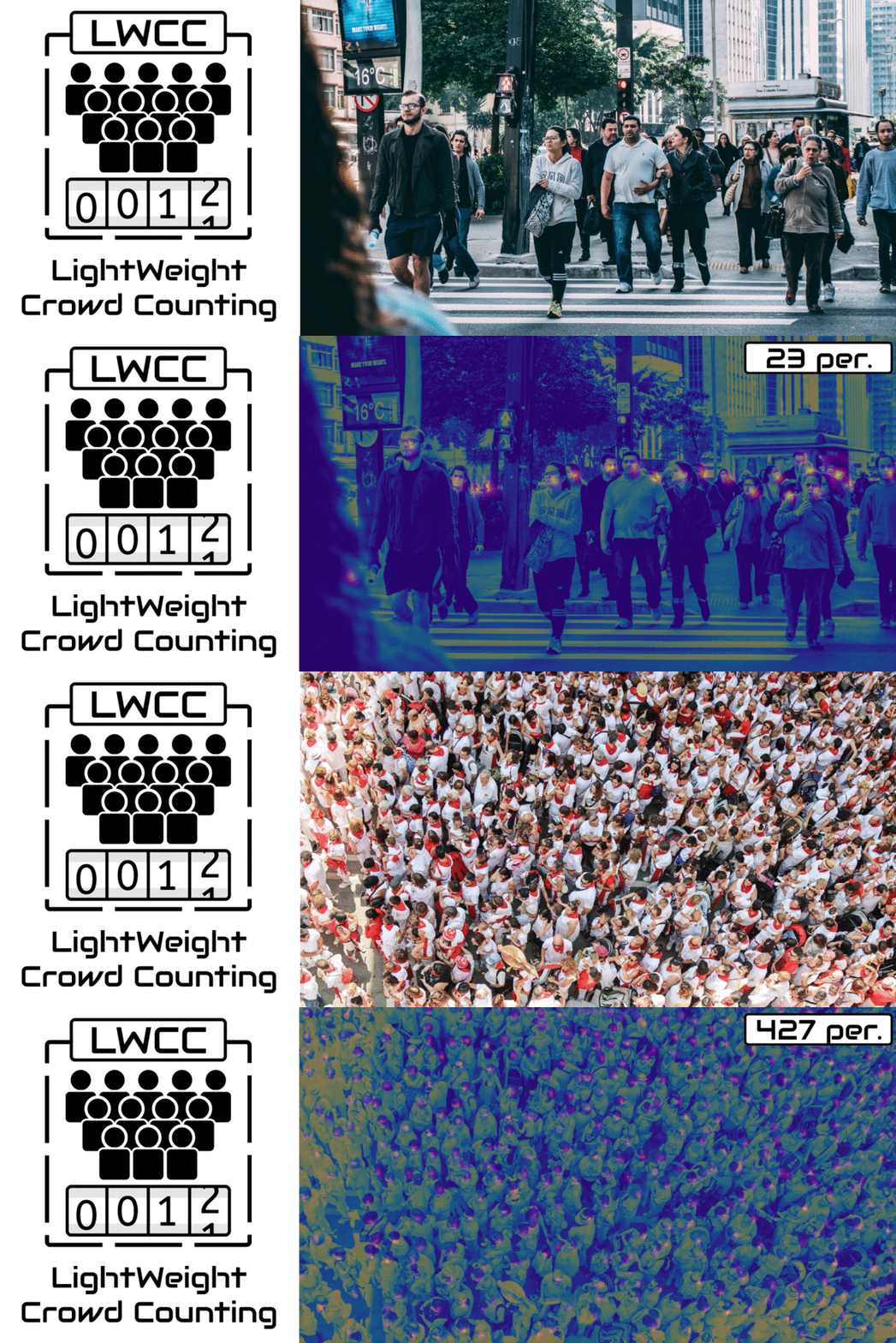
LWCC: A LightWeight Crowd Counting library for Python LWCC is a lightweight crowd counting framework for Python. It wraps four state-of-the-art models
A course-planning, course-map rendering and GPA-calculation web service, designed for the SFU (Simon Fraser University) student.
SFU Course Planner What is the overall goal of the project (i.e. what does it do, or what problem is it solving)? As the title suggests, this project

Retentioneering: product analytics, data-driven customer journey map optimization, marketing analytics, web analytics, transaction analytics, graph visualization, and behavioral segmentation with customer segments in Python.
What is Retentioneering? Retentioneering is a Python framework and library to assist product analysts and marketing analysts as it makes it easier to
Simple package to enhance Python's concurrent.futures for memory efficiency
future-map is a Python library to use together with the official concurrent.futures module.

Class activation maps for your PyTorch models (CAM, Grad-CAM, Grad-CAM++, Smooth Grad-CAM++, Score-CAM, SS-CAM, IS-CAM, XGrad-CAM, Layer-CAM)
TorchCAM: class activation explorer Simple way to leverage the class-specific activation of convolutional layers in PyTorch. Quick Tour Setting your C
A script to "SHUA" H1-2 map of Mercenaries mode of Hearthstone
lushi_script Introduction This script is to "SHUA" H1-2 map of Mercenaries mode of Hearthstone Installation Make sure you installed python=3.6. To in

Benchmark tools for Compressive LiDAR-to-map registration
Benchmark tools for Compressive LiDAR-to-map registration This repo contains the released version of code and datasets used for our IROS 2021 paper: "

This is an interactive MiniMap made with Python, PyQT5 & Pytesseract for the game
NWMM-New-World-MiniMap Features: Automatically grabs position from "New World" Instance Live visualisation of player position on MiniMap Circular & re

This YoloV5 based model is fit to detect people and different types of land vehicles, and displaying their density on a fitted map, according to their coordinates and detected labels.
This YoloV5 based model is fit to detect people and different types of land vehicles, and displaying their density on a fitted map, according to their

Pytorch Feature Map Extractor
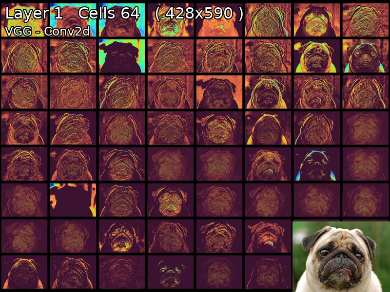
MapExtrackt Convolutional Neural Networks Are Beautiful We all take our eyes for granted, we glance at an object for an instant and our brains can ide

Many Class Activation Map methods implemented in Pytorch for CNNs and Vision Transformers. Including Grad-CAM, Grad-CAM++, Score-CAM, Ablation-CAM and XGrad-CAM
Class Activation Map methods implemented in Pytorch pip install grad-cam ⭐ Comprehensive collection of Pixel Attribution methods for Computer Vision.
Prop-based map editor for the Apex Legends mod, R5Reloaded
R5R Map Editor A tool to build maps out of props in the Apex Legends mod, R5Reloaded Instuctions Install R5R Download this program Get the prop spawne

Official implementation of "StyleCariGAN: Caricature Generation via StyleGAN Feature Map Modulation" (SIGGRAPH 2021)
StyleCariGAN: Caricature Generation via StyleGAN Feature Map Modulation This repository contains the official PyTorch implementation of the following

GBIM(Gesture-Based Interaction map)
手势交互地图 GBIM(Gesture-Based Interaction map),基于视觉深度神经网络的交互地图,通过电脑摄像头观察使用者的手势变化,进而控制地图进行简单的交互。网络使用PaddleX提供的轻量级模型PPYOLO Tiny以及MobileNet V3 small,使得整个模型大小约10MB左右,即使在CPU下也能快速定位和识别手势。
Easily map device and application controls to a midi controller
pymidicontroller Introduction Easily map device and application controls to a midi controller
Chemical equation balancer
Chemical equation balancer Balance your chemical equations with ease! Installation $ git clone [email protected]:InCogNiTo124/chemeq.git && cd chemeq; $

Many Class Activation Map methods implemented in Pytorch for CNNs and Vision Transformers. Including Grad-CAM, Grad-CAM++, Score-CAM, Ablation-CAM and XGrad-CAM
Class Activation Map methods implemented in Pytorch pip install grad-cam ⭐ Tested on many Common CNN Networks and Vision Transformers. ⭐ Includes smoo
Pip-package for trajectory benchmarking from "Be your own Benchmark: No-Reference Trajectory Metric on Registered Point Clouds", ECMR'21
Map Metrics for Trajectory Quality Map metrics toolkit provides a set of metrics to quantitatively evaluate trajectory quality via estimating consiste

Google Maps keeps old satellite imagery around for a while – this tool collects what's available for a user-specified region in the form of a GIF.
google-maps-at-88-mph The folks maintaining Google Maps regularly update the satellite imagery it serves its users, but outdated versions of the image

Replace MSFS2020's bing map to google map
English verison here 中文 免责声明 本教程提到的方法仅用于研究和学习用途。我不对使用、拓展该教程及方法所造成的任何法律责任和损失负责。 背景 微软模拟飞行2020的地景使用了Bing的卫星地图,然而卫星地图比较老旧,很多地区都是几年前的图设置直接是没有的。这种现象在全球不同地区
A linear equation solver using gaussian elimination. Implemented for fun and learning/teaching.
A linear equation solver using gaussian elimination. Implemented for fun and learning/teaching. The solver will solve equations of the type: A can be
