Country-info
A python code getting countries information including country's map and QR-code encoding the country's information!
Check the requirements.txt file to install necessary packages.
A python code getting countries information including country's map and QR-code encoding the country's information!
Check the requirements.txt file to install necessary packages.
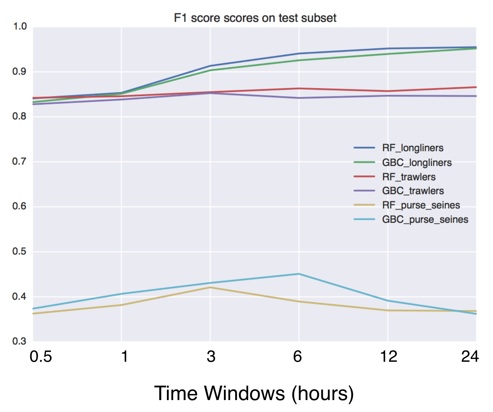
Using Global fishing watch's data to build a machine learning model that can identify illegal fishing and poaching activities through satellite and geo-location data.
folium Python Data, Leaflet.js Maps folium builds on the data wrangling strengths of the Python ecosystem and the mapping strengths of the Leaflet.js
GeoPandas Python tools for geographic data Introduction GeoPandas is a project to add support for geographic data to pandas objects. It currently impl
EarthPy EarthPy makes it easier to plot and manipulate spatial data in Python. Why EarthPy? Python is a generic programming language designed to suppo
Satpy The Satpy package is a python library for reading and manipulating meteorological remote sensing data and writing it to various image and data f
Location Data Visualization library for Jupyter Notebooks Library documentation at https://mapbox-mapboxgl-jupyter.readthedocs-hosted.com/en/latest/.
geoplotlib is a python toolbox for visualizing geographical data and making maps data = read_csv('data/bus.csv') geoplotlib.dot(data) geoplotlib.show(
OSMnx OSMnx is a Python package that lets you download geospatial data from OpenStreetMap and model, project, visualize, and analyze real-world street
eo-box eobox is a Python package with a small collection of tools for working with Remote Sensing / Earth Observation data. Package Overview So far, t
ColoringMapAlgorithm-CSP- Condition Satisfaction Algorithm Output Condition
Zora Zora is a python program that searches for GeoLocation info for given CIDR networks , with options to search with API or without API Installing a
Bike parking tweepy bot app A twitter bot app that searches for bicycle parking added to OpenStreetMap. Relies on AWS Lambda/S3, Python3, Tweepy, Flas
IP address & Location finder @DEV/ED : Pavan Ananth Sharma Dependencies: ip2geotools Note: use pip install ip2geotools to install this in your termin
geojson-area Calculate the area inside of any GeoJSON geometry. This is a port of Mapbox's geojson-area for Python. Installation $ pip install area U
geextract Google Earth Engine data extraction tool. Quickly obtain Landsat multispectral time-series for exploratory analysis and algorithm testing On
WeatherApp Content Brief description Tools Features Hotkeys How it works Screenshots Ways to improve the project Installation Brief description This G
satellite-visualization A cross-platform application to calculate & view the trajectory and live position of any earth-orbiting satellite in 3D. This
Open Data Cube Core Overview The Open Data Cube Core provides an integrated gridded data analysis environment for decades of analysis ready earth obse
TransLink Spatial Data What: TransLink is the statutory public transit authority for the Metro Vancouver region. This GitHub repository is a collectio

