16 Repositories
Python geo Libraries
Sky Computing: Accelerating Geo-distributed Computing in Federated Learning
Sky Computing Introduction Sky Computing is a load-balanced framework for federated learning model parallelism. It adaptively allocate model layers to
Code for our paper A Transformer-Based Feature Segmentation and Region Alignment Method For UAV-View Geo-Localization,
FSRA This repository contains the dataset link and the code for our paper A Transformer-Based Feature Segmentation and Region Alignment Method For UAV

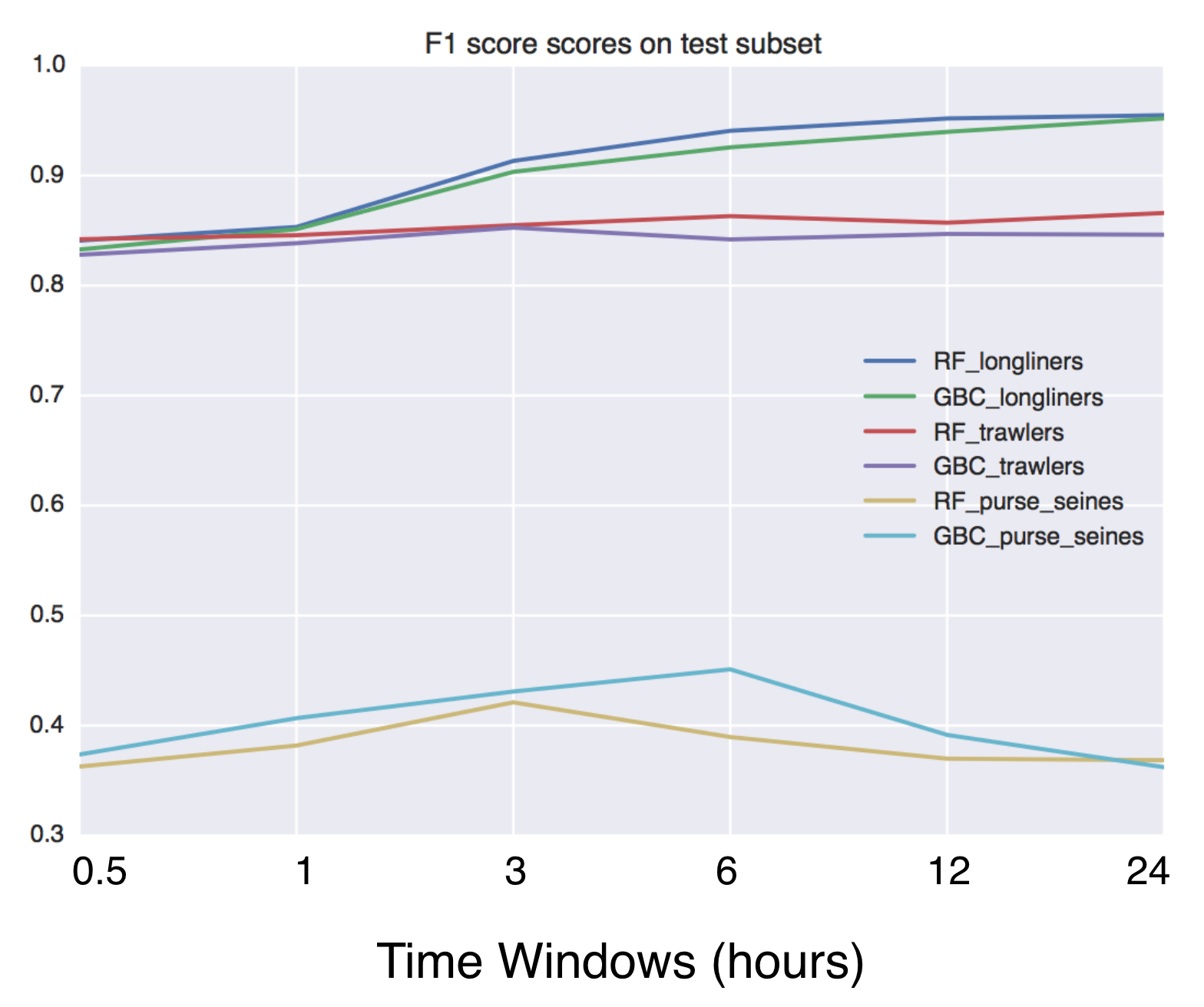
Using Global fishing watch's data to build a machine learning model that can identify illegal fishing and poaching activities through satellite and geo-location data.
Using Global fishing watch's data to build a machine learning model that can identify illegal fishing and poaching activities through satellite and geo-location data.
Weak-supervised Visual Geo-localization via Attention-based Knowledge Distillation
Weak-supervised Visual Geo-localization via Attention-based Knowledge Distillation Introduction WAKD is a PyTorch implementation for our ICPR-2022 pap

A service to auto provision devices in Aruba Central based on the Geo-IP location
Location Based Provisioning Service for Aruba Central A service to auto provision devices in Aruba Central based on the Geo-IP location Geo-IP auto pr
WIP: extracting Geometry utilities from datacube-core
odc.geo This is still work in progress. This repository contains geometry related code extracted from Open Datacube. For details and motivation see OD
Evaluation of file formats in the context of geo-referenced 3D geometries.
Geo-referenced Geometry File Formats Classic geometry file formats as .obj, .off, .ply, .stl or .dae do not support the utilization of coordinate syst

A Transformer-Based Feature Segmentation and Region Alignment Method For UAV-View Geo-Localization
University1652-Baseline [Paper] [Slide] [Explore Drone-view Data] [Explore Satellite-view Data] [Explore Street-view Data] [Video Sample] [中文介绍] This
Early version for manipulate Geo localization data trough API REST.
Backend para obtener los datos (beta) Descripción El servidor está diseñado para recibir y almacenar datos enviados en forma de JSON por una aplicació

A toolkit for geo ML data processing and model evaluation (fork of solaris)
An open source ML toolkit for overhead imagery. This is a beta version of lunular which may continue to develop. Please report any bugs through issues

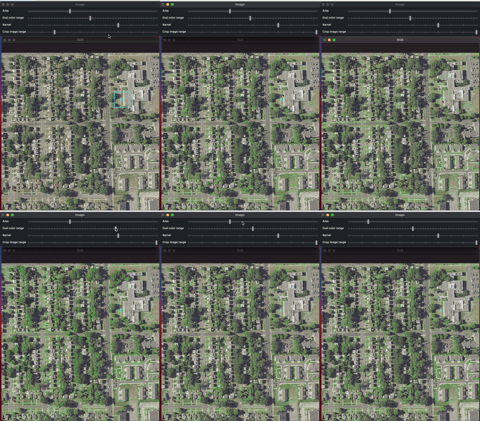
This repo contains a script that allows us to find range of colors in images using openCV, and then convert them into geo vectors.
Vectorizing color range This repo contains a script that allows us to find range of colors in images using openCV, and then convert them into geo vect

Code and data for "Broaden the Vision: Geo-Diverse Visual Commonsense Reasoning" (EMNLP 2021).
GD-VCR Code for Broaden the Vision: Geo-Diverse Visual Commonsense Reasoning (EMNLP 2021). Research Questions and Aims: How well can a model perform o

The Django Leaflet Admin List package provides an admin list view featured by the map and bounding box filter for the geo-based data of the GeoDjango.
The Django Leaflet Admin List package provides an admin list view featured by the map and bounding box filter for the geo-based data of the GeoDjango. It requires a django-leaflet package.
Asynchronous Client for the worlds fastest in-memory geo-database Tile38
This is an asynchonous Python client for Tile38 that allows for fast and easy interaction with the worlds fastest in-memory geodatabase Tile38.

Pytorch implementation of Each Part Matters: Local Patterns Facilitate Cross-view Geo-localization https://arxiv.org/abs/2008.11646
[TCSVT] Each Part Matters: Local Patterns Facilitate Cross-view Geo-localization LPN [Paper] NEWs Prerequisites Python 3.6 GPU Memory = 8G Numpy 1.