50 Repositories
Python g-earth Libraries
🛰️ List of earth observation companies and job sites
Earth Observation Companies & Jobs source Portals & Jobs Geospatial Geospatial jobs newsletter: ~biweekly newsletter with geospatial jobs by Ali Ahmad

Enable geospatial data mining through Google Earth Engine in Grasshopper 3D, via its most recent Hops component.
AALU_Geo Mining This repository is produced for a masterclass at the Architectural Association Landscape Urbanism programme. Requirements Rhinoceros (
The NEOSSat is a dual-mission microsatellite designed to detect potentially hazardous Earth-orbit-crossing asteroids and track objects that reside in deep space
The NEOSSat is a dual-mission microsatellite designed to detect potentially hazardous Earth-orbit-crossing asteroids and track objects that reside in deep space

An introduction to satellite image analysis using Python + OpenCV and JavaScript + Google Earth Engine
A Gentle Introduction to Satellite Image Processing Welcome to this introductory course on Satellite Image Analysis! Satellite imagery has become a pr

Analyzing Earth Observation (EO) data is complex and solutions often require custom tailored algorithms.
eo-grow Earth observation framework for scaled-up processing in Python. Analyzing Earth Observation (EO) data is complex and solutions often require c

🛰️ Awesome Satellite Imagery Datasets
Awesome Satellite Imagery Datasets List of aerial and satellite imagery datasets with annotations for computer vision and deep learning. Newest datase

Global topography (referenced to sea-level) in a 10 arcminute resolution grid
Earth - Topography grid at 10 arc-minute resolution Global 10 arc-minute resolution grids of topography (ETOPO1 ice-surface) referenced to mean sea-le
GEGVL: Google Earth Based Geoscience Video Library
Google Earth Based Geoscience Video Library is transforming to Server Based. The
Deep learning with TensorFlow and earth observation data.
Deep Learning with TensorFlow and EO Data Complete file set for Jupyter Book Autor: Development Seed Date: 04 October 2021 ISBN: (to come) Notebook tu
Python package for downloading ECMWF reanalysis data and converting it into a time series format.
ecmwf_models Readers and converters for data from the ECMWF reanalysis models. Written in Python. Works great in combination with pytesmo. Citation If
PyTorch EO aims to make Deep Learning for Earth Observation data easy and accessible to real-world cases and research alike.
Pytorch EO Deep Learning for Earth Observation applications and research. 🚧 This project is in early development, so bugs and breaking changes are ex

A ninja python package that unifies the Google Earth Engine ecosystem.
A Python package that unifies the Google Earth Engine ecosystem. EarthEngine.jl | rgee | rgee+ | eemont GitHub: https://github.com/r-earthengine/ee_ex
ESMAC diags - Earth System Model Aerosol-Cloud Diagnostics Package
Earth System Model Aerosol-Cloud Diagnostics Package This Earth System Model (ES
Earthengine-py-notebooks - A collection of 360+ Jupyter Python notebook examples for using Google Earth Engine with interactive mapping
earthengine-py-notebooks A collection of 360+ Jupyter Python notebook examples for using Google Earth Engine with interactive mapping Contact: Qiushen
Calculate & view the trajectory and live position of any earth-orbiting satellite
satellite-visualization A cross-platform application to calculate & view the trajectory and live position of any earth-orbiting satellite in 3D. This

A python package that extends Google Earth Engine.
A python package that extends Google Earth Engine GitHub: https://github.com/davemlz/eemont Documentation: https://eemont.readthedocs.io/ PyPI: https:

Official Implementation for the paper DeepFace-EMD: Re-ranking Using Patch-wise Earth Mover’s Distance Improves Out-Of-Distribution Face Identification
DeepFace-EMD: Re-ranking Using Patch-wise Earth Mover’s Distance Improves Out-Of-Distribution Face Identification Official Implementation for the pape
Interactive web apps created using geemap and streamlit
geemap-apps Introduction This repo demostrates how to build a multi-page Earth Engine App using streamlit and geemap. You can deploy the app on variou
Earth-to-orbit ballistic trajectories with atmospheric resistance
Earth-to-orbit ballistic trajectories with atmospheric resistance Overview Space guns are a theoretical technology that reduces the cost of getting bu
Shared utility scripts for AI for Earth projects and team members
Overview Shared utilities developed by the Microsoft AI for Earth team The general convention in this repo is that users who want to consume these uti
Fast EMD for Python: a wrapper for Pele and Werman's C++ implementation of the Earth Mover's Distance metric
PyEMD: Fast EMD for Python PyEMD is a Python wrapper for Ofir Pele and Michael Werman's implementation of the Earth Mover's Distance that allows it to
A Python implementation of Jerome Friedman's Multivariate Adaptive Regression Splines
py-earth A Python implementation of Jerome Friedman's Multivariate Adaptive Regression Splines algorithm, in the style of scikit-learn. The py-earth p
Doom o’clock is a website/project that features a countdown of “when will the earth end” and a greenhouse gas effect emission prediction that’s predicted
Doom o’clock is a website/project that features a countdown of “when will the earth end” and a greenhouse gas effect emission prediction that’s predicted
Earth centric orbit propagation tool. Built from scratch in python.
Orbit-Propogator Earth centric orbit propagation tool. Built from scratch in python. Functionality includes: tracking sattelite location over time plo
✨ A simple project to automate some stuffs in Habbo with G-Earth ✨
⚡️ Habbo G-Earth extensions ⚡️ ✨ A simple project to automate some stuffs in Habbo with G-Earth ✨ About | Getting Started | Authors ➤ Getting Started

Digital Earth Australia notebooks and tools repository
Repository for Digital Earth Australia Jupyter Notebooks: tools and workflows for geospatial analysis with Open Data Cube and xarray

Can we visualize a large scientific data set with a surrogate model? We're building a GAN for the Earth's Mantle Convection data set to see if we can!
EarthGAN - Earth Mantle Surrogate Modeling Can a surrogate model of the Earth’s Mantle Convection data set be built such that it can be readily run in

eoplatform is a Python package that aims to simplify Remote Sensing Earth Observation by providing actionable information on a wide swath of RS platforms and provide a simple API for downloading and visualizing RS imagery
An Earth Observation Platform Earth Observation made easy. Report Bug | Request Feature About eoplatform is a Python package that aims to simplify Rem

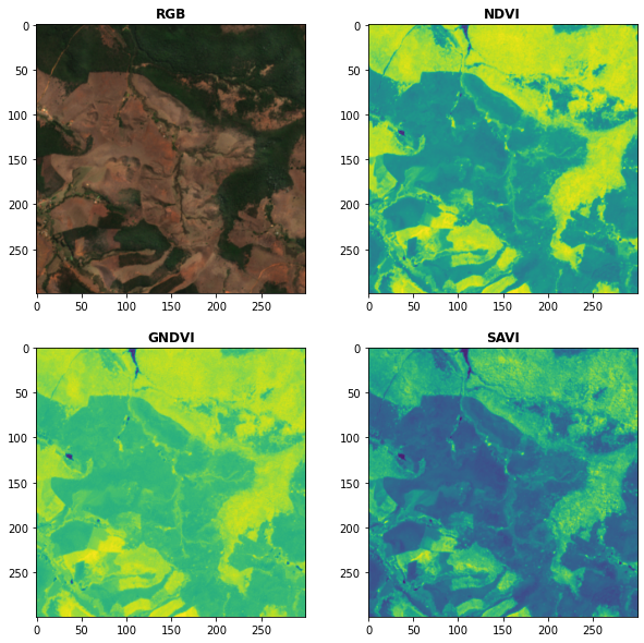
Awesome Spectral Indices in Python.
Awesome Spectral Indices in Python: Numpy | Pandas | GeoPandas | Xarray | Earth Engine | Planetary Computer | Dask GitHub: https://github.com/davemlz/

A simple python script that, given a location and a date, uses the Nasa Earth API to show a photo taken by the Landsat 8 satellite. The script must be executed on the command-line.
What does it do? Given a location and a date, it uses the Nasa Earth API to show a photo taken by the Landsat 8 satellite. The script must be executed

Build, deploy and extract satellite public constellations with one command line.
SatExtractor Build, deploy and extract satellite public constellations with one command line. Table of Contents About The Project Getting Started Stru

PyGMT - A Python interface for the Generic Mapping Tools
PyGMT A Python interface for the Generic Mapping Tools Documentation (development version) | Contact | Try Online Why PyGMT? A beautiful map is worth
EODAG is a command line tool and a plugin-oriented Python framework for searching, aggregating results and downloading remote sensed images while offering a unified API for data access regardless of the data provider
EODAG (Earth Observation Data Access Gateway) is a command line tool and a plugin-oriented Python framework for searching, aggregating results and downloading remote sensed images while offering a unified API for data access regardless of the data provider
Open Data Cube analyses continental scale Earth Observation data through time
Open Data Cube Core Overview The Open Data Cube Core provides an integrated gridded data analysis environment for decades of analysis ready earth obse

A ready-to-use curated list of Spectral Indices for Remote Sensing applications.
A ready-to-use curated list of Spectral Indices for Remote Sensing applications. GitHub: https://github.com/davemlz/awesome-ee-spectral-indices Docume
Earth Vision Foundation
EVer - A Library for Earth Vision Researcher EVer is a Pytorch-based Python library to simplify the training and inference of the deep learning model.

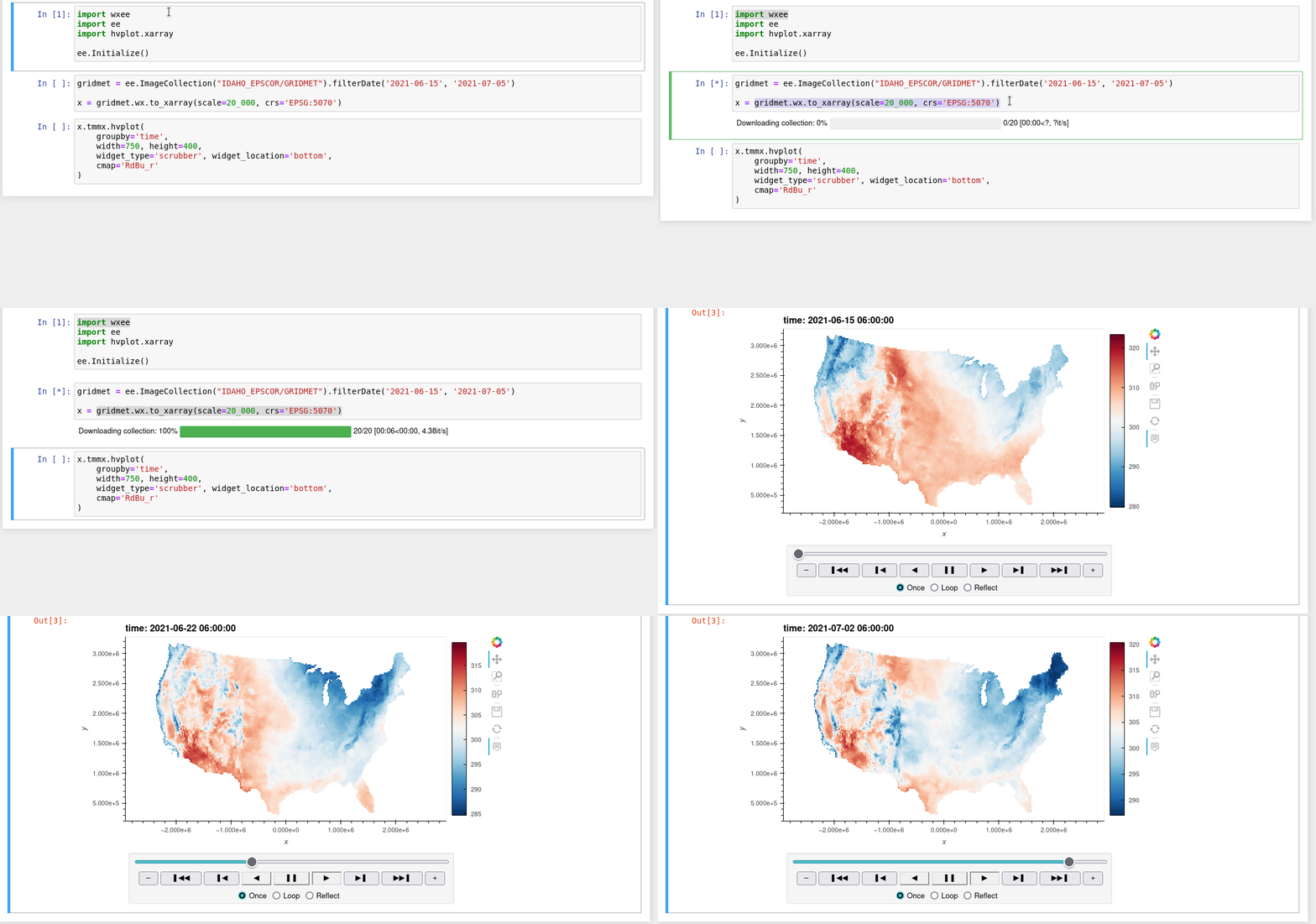
A Python interface between Earth Engine and xarray for processing weather and climate data
wxee What is wxee? wxee was built to make processing gridded, mesoscale time series weather and climate data quick and easy by integrating the data ca

A Python interface between Earth Engine and xarray
eexarray A Python interface between Earth Engine and xarray Description eexarray was built to make processing gridded, mesoscale time series data quic
EOReader is a multi-satellite reader allowing you to open optical and SAR data.
Remote-sensing opensource python library reading optical and SAR sensors, loading and stacking bands, clouds, DEM and index.

Flood Detection with Google Earth Engine
ee-fastapi: Flood Detection System A ee-fastapi is a simple FastAPI web application for performing flood detection using Google Earth Engine in the ba

Visualize classified time series data with interactive Sankey plots in Google Earth Engine
sankee Visualize changes in classified time series data with interactive Sankey plots in Google Earth Engine Contents Description Installation Using P
Satellite imagery for dummies.
felicette Satellite imagery for dummies. What can you do with this tool? TL;DR: Generate JPEG earth imagery from coordinates/location name with public

Get Landsat surface reflectance time-series from google earth engine
geextract Google Earth Engine data extraction tool. Quickly obtain Landsat multispectral time-series for exploratory analysis and algorithm testing On
A toolbox for processing earth observation data with Python.
eo-box eobox is a Python package with a small collection of tools for working with Remote Sensing / Earth Observation data. Package Overview So far, t
framework for large-scale SAR satellite data processing
pyroSAR A Python Framework for Large-Scale SAR Satellite Data Processing The pyroSAR package aims at providing a complete solution for the scalable or

Processing and interpolating spatial data with a twist of machine learning
Documentation | Documentation (dev version) | Contact | Part of the Fatiando a Terra project About Verde is a Python library for processing spatial da

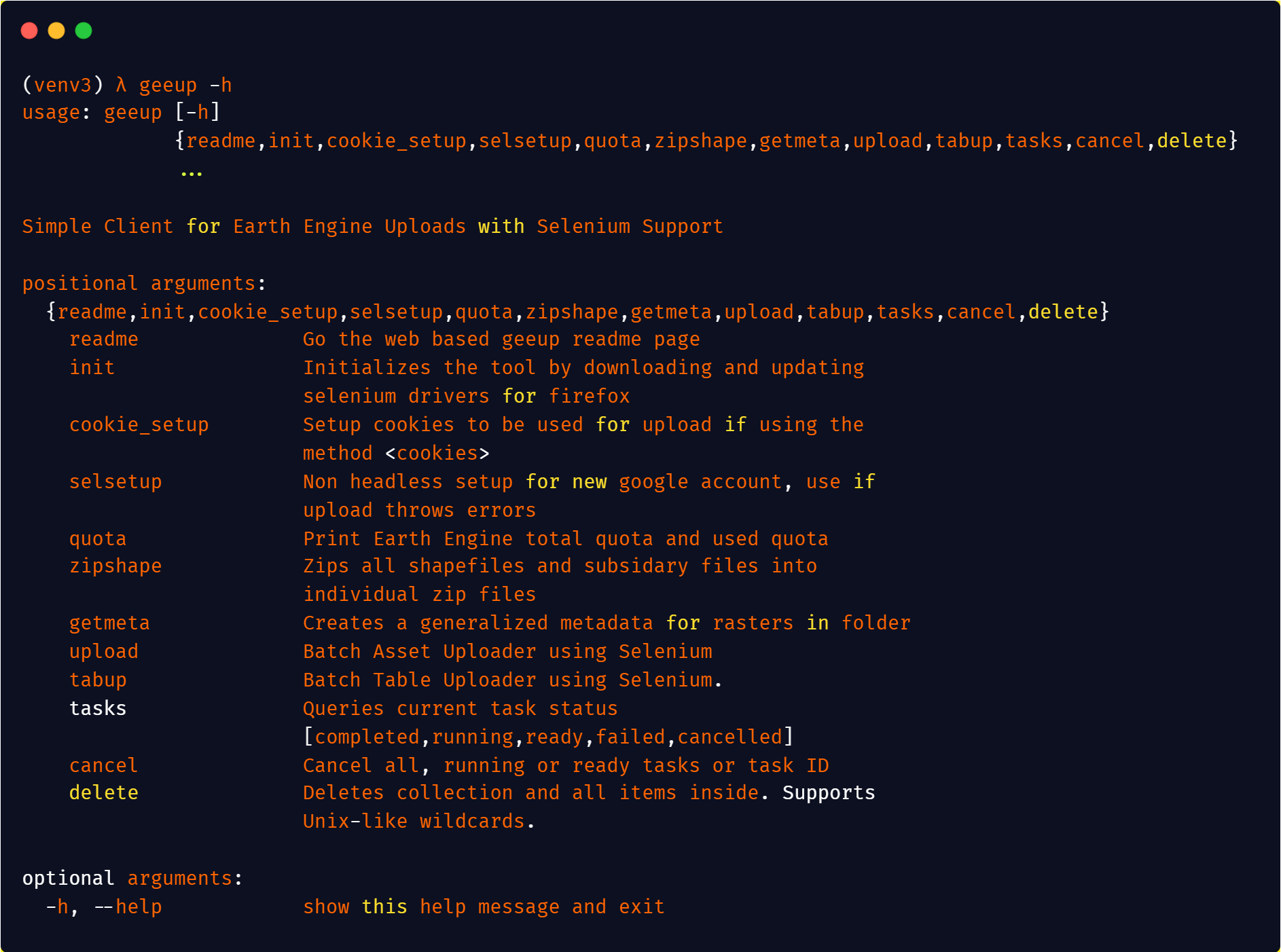
Simple CLI for Google Earth Engine Uploads
geeup: Simple CLI for Earth Engine Uploads with Selenium Support This tool came of the simple need to handle batch uploads of both image assets to col
geemap - A Python package for interactive mapping with Google Earth Engine, ipyleaflet, and ipywidgets.
A Python package for interactive mapping with Google Earth Engine, ipyleaflet, and folium
Python package for earth-observing satellite data processing
Satpy The Satpy package is a python library for reading and manipulating meteorological remote sensing data and writing it to various image and data f
How on earth can I ever think of a solution like that in an interview?!
fuck-coding-interviews This repository is created by an awkward programmer who always struggles with coding problems on LeetCode, even with some Easy