48 Repositories
Python gis Libraries

Course materials for: Geospatial Data Science
Course materials for: Geospatial Data Science These course materials cover the lectures for the course held for the first time in spring 2022 at IT Un
Specification for storing geospatial vector data (point, line, polygon) in Parquet
GeoParquet About This repository defines how to store geospatial vector data (point, lines, polygons) in Apache Parquet, a popular columnar storage fo

An attempt to map the areas with active conflict in Ukraine using open source twitter data.
Live Action Map (LAM) An attempt to use open source data on Twitter to map areas with active conflict. Right now it is used for the Ukraine-Russia con

Awesome Remote Sensing Toolkit based on PaddlePaddle.
基于飞桨框架开发的高性能遥感图像处理开发套件,端到端地完成从训练到部署的全流程遥感深度学习应用。 最新动态 PaddleRS 即将发布alpha版本!欢迎大家试用 简介 PaddleRS是遥感科研院所、相关高校共同基于飞桨开发的遥感处理平台,支持遥感图像分类,目标检测,图像分割,以及变化检测等常用遥

A python package for generating, analyzing and visualizing building shadows
pybdshadow Introduction pybdshadow is a python package for generating, analyzing and visualizing building shadows from large scale building geographic

Advanced raster and geometry manipulations
buzzard In a nutshell, the buzzard library provides powerful abstractions to manipulate together images and geometries that come from different kind o
Active Transport Analytics Model: A new strategic transport modelling and data visualization framework
{ATAM} Active Transport Analytics Model Active Transport Analytics Model (“ATAM”

A ninja python package that unifies the Google Earth Engine ecosystem.
A Python package that unifies the Google Earth Engine ecosystem. EarthEngine.jl | rgee | rgee+ | eemont GitHub: https://github.com/r-earthengine/ee_ex
Earthengine-py-notebooks - A collection of 360+ Jupyter Python notebook examples for using Google Earth Engine with interactive mapping
earthengine-py-notebooks A collection of 360+ Jupyter Python notebook examples for using Google Earth Engine with interactive mapping Contact: Qiushen

ProjPicker (projection picker) is a Python module that allows the user to select all coordinate reference systems (CRSs)
ProjPicker ProjPicker (projection picker) is a Python module that allows the user to select all coordinate reference systems (CRSs) whose extent compl

Raster processing benchmarks for Python and R packages
Raster processing benchmarks This repository contains a collection of raster processing benchmarks for Python and R packages. The tests cover the most

GetOSM is an OpenStreetMap tile downloader written in Python that is agnostic of GUI frameworks.
GetOSM GetOSM is an OpenStreetMap tile downloader written in Python that is agnostic of GUI frameworks. It is used with tkinter by ProjPicker. Require

Spaghetti: an open-source Python library for the analysis of network-based spatial data
pysal/spaghetti SPAtial GrapHs: nETworks, Topology, & Inference Spaghetti is an open-source Python library for the analysis of network-based spatial d

A python package that extends Google Earth Engine.
A python package that extends Google Earth Engine GitHub: https://github.com/davemlz/eemont Documentation: https://eemont.readthedocs.io/ PyPI: https:

The geospatial toolkit for redistricting data.
maup maup is the geospatial toolkit for redistricting data. The package streamlines the basic workflows that arise when working with blocks, precincts

Deep Learning Datasets Maker is a QGIS plugin to make datasets creation easier for raster and vector data.
Deep Learning Dataset Maker Deep Learning Datasets Maker is a QGIS plugin to make datasets creation easier for raster and vector data. How to use Down

Pytorch GUI(demo) for iVOS(interactive VOS) and GIS (Guided iVOS)
GUI for iVOS(interactive VOS) and GIS (Guided iVOS) GUI Implementation of CVPR2021 paper "Guided Interactive Video Object Segmentation Using Reliabili

🌐 Local tile server for viewing geospatial raster files with ipyleaflet or folium
🌐 Local Tile Server for Geospatial Rasters Need to visualize a rather large (gigabytes) raster you have locally? This is for you. A Flask application
Vector tile server for the Wildfire Predictive Services Unit
wps-tileserver Vector tile server for the Wildfire Predictive Services Unit Overview The intention of this project is to: provide tools to easily spin
PySpark bindings for H3, a hierarchical hexagonal geospatial indexing system
h3-pyspark: Uber's H3 Hexagonal Hierarchical Geospatial Indexing System in PySpark PySpark bindings for the H3 core library. For available functions,

A tool for automatically generating 3D printable STLs from freely available lidar scan data.
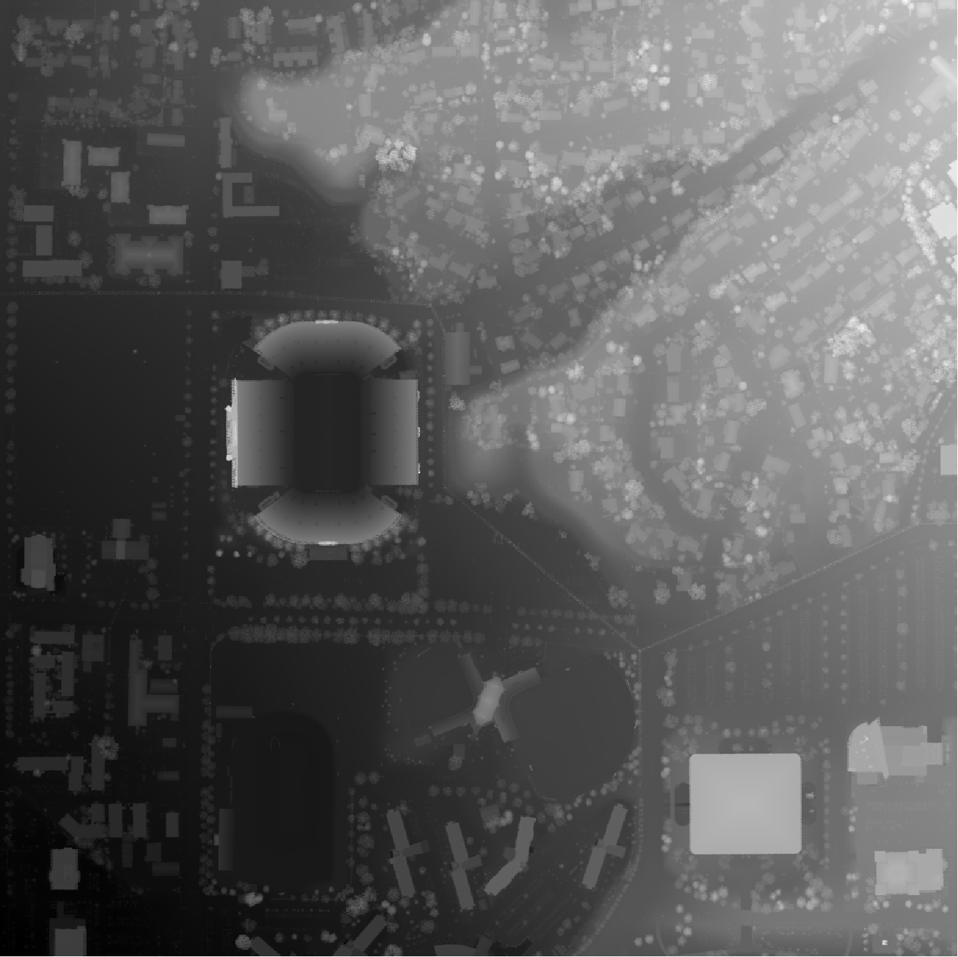
mini-map-maker A tool for automatically generating 3D printable STLs from freely available lidar scan data. Screenshots Tutorial To use this script, g

Spatial Interpolation Toolbox is a Python-based GUI that is able to interpolate spatial data in vector format.
Spatial Interpolation Toolbox This is the home to Spatial Interpolation Toolbox, a graphical user interface (GUI) for interpolating geographic vector

eoplatform is a Python package that aims to simplify Remote Sensing Earth Observation by providing actionable information on a wide swath of RS platforms and provide a simple API for downloading and visualizing RS imagery
An Earth Observation Platform Earth Observation made easy. Report Bug | Request Feature About eoplatform is a Python package that aims to simplify Rem

GeoNode is an open source platform that facilitates the creation, sharing, and collaborative use of geospatial data.
Table of Contents What is GeoNode? Try out GeoNode Install Learn GeoNode Development Contributing Roadmap Showcase Most useful links Licensing What is
EODAG is a command line tool and a plugin-oriented Python framework for searching, aggregating results and downloading remote sensed images while offering a unified API for data access regardless of the data provider
EODAG (Earth Observation Data Access Gateway) is a command line tool and a plugin-oriented Python framework for searching, aggregating results and downloading remote sensed images while offering a unified API for data access regardless of the data provider
Hapi is a Python library for building Conceptual Distributed Model using HBV96 lumped model & Muskingum routing method
Current build status All platforms: Current release info Name Downloads Version Platforms Hapi - Hydrological library for Python Hapi is an open-sourc
Open Data Cube analyses continental scale Earth Observation data through time
Open Data Cube Core Overview The Open Data Cube Core provides an integrated gridded data analysis environment for decades of analysis ready earth obse
Geographic add-ons for Django REST Framework. Maintained by the OpenWISP Project.
Geographic add-ons for Django REST Framework. Maintained by the OpenWISP Project.
Geographic add-ons for Django REST Framework. Maintained by the OpenWISP Project.
django-rest-framework-gis Geographic add-ons for Django Rest Framework - Mailing List. Install last stable version from pypi pip install djangorestfra

A ready-to-use curated list of Spectral Indices for Remote Sensing applications.
A ready-to-use curated list of Spectral Indices for Remote Sensing applications. GitHub: https://github.com/davemlz/awesome-ee-spectral-indices Docume

A Python interface between Earth Engine and xarray for processing weather and climate data
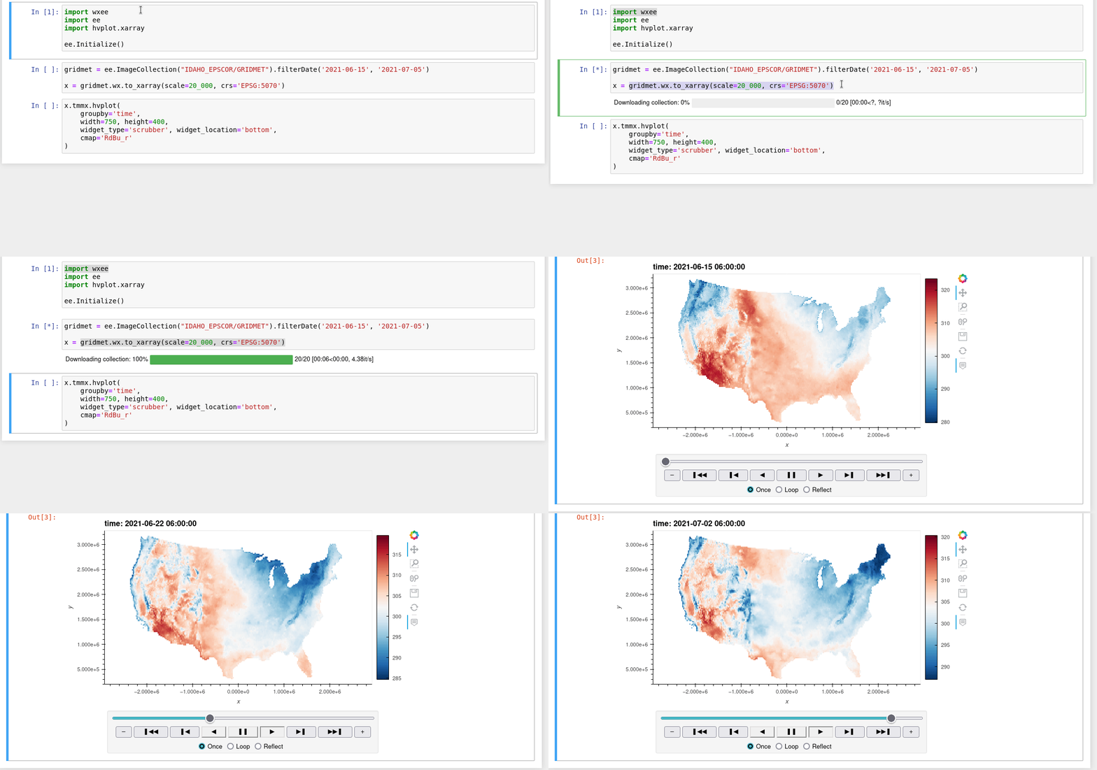
wxee What is wxee? wxee was built to make processing gridded, mesoscale time series weather and climate data quick and easy by integrating the data ca

Google Maps keeps old satellite imagery around for a while – this tool collects what's available for a user-specified region in the form of a GIF.
google-maps-at-88-mph The folks maintaining Google Maps regularly update the satellite imagery it serves its users, but outdated versions of the image

A Python interface between Earth Engine and xarray
eexarray A Python interface between Earth Engine and xarray Description eexarray was built to make processing gridded, mesoscale time series data quic
This is a method to build your own qgis configuration packages using osgeo4W.
This is a method to build your own qgis configuration packages using osgeo4W. Then you can automate deployment in your organization with a controled and trusted environnement.
leafmap - A Python package for geospatial analysis and interactive mapping in a Jupyter environment.
A Python package for geospatial analysis and interactive mapping with minimal coding in a Jupyter environment
geobeam - adds GIS capabilities to your Apache Beam and Dataflow pipelines.
geobeam adds GIS capabilities to your Apache Beam pipelines. What does geobeam do? geobeam enables you to ingest and analyze massive amounts of geospa
Satellite imagery for dummies.
felicette Satellite imagery for dummies. What can you do with this tool? TL;DR: Generate JPEG earth imagery from coordinates/location name with public

Blender addons to make the bridge between Blender and geographic data
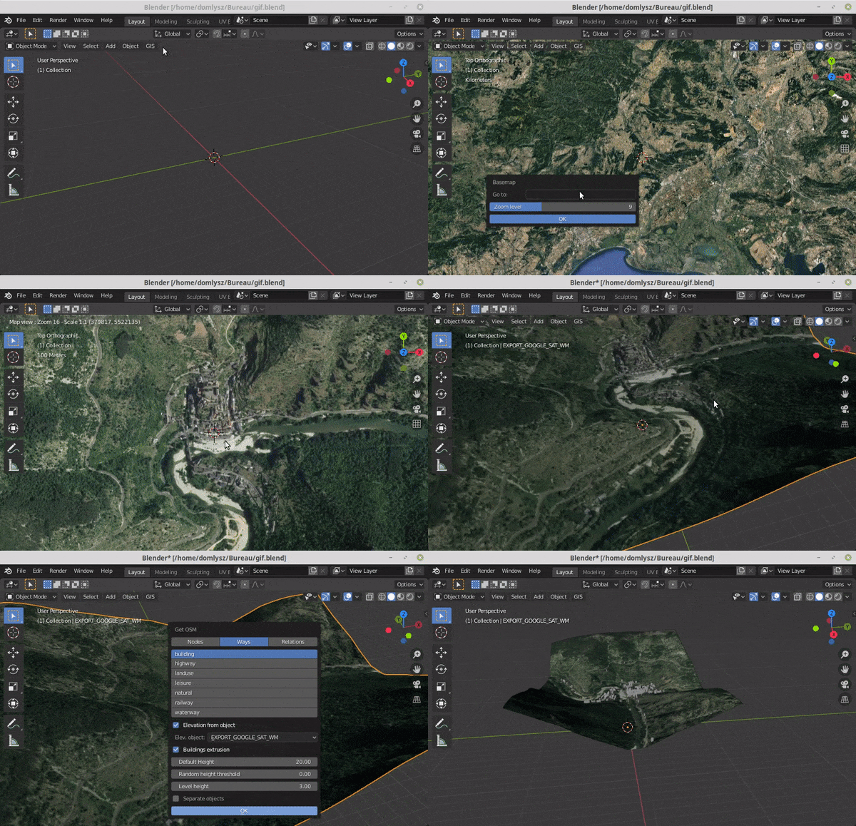
Blender GIS Blender minimal version : 2.8 Mac users warning : currently the addon does not work on Mac with Blender 2.80 to 2.82. Please do not report
ArcGIS Python Toolbox for WhiteboxTools
WhiteboxTools-ArcGIS ArcGIS Python Toolbox for WhiteboxTools. This repository is related to the ArcGIS Python Toolbox for WhiteboxTools, which is an A
WhiteboxTools Python Frontend
whitebox-python Important Note This repository is related to the WhiteboxTools Python Frontend only. You can report issues to this repo if you have pr
A Python package for delineating nested surface depressions from digital elevation data.
Welcome to the lidar package lidar is Python package for delineating the nested hierarchy of surface depressions in digital elevation models (DEMs). I

peartree: A library for converting transit data into a directed graph for sketch network analysis.
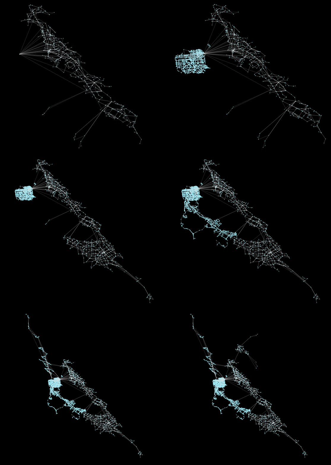
peartree 🍐 🌳 peartree is a library for converting GTFS feed schedules into a representative directed network graph. The tool uses Partridge to conve
OSMnx: Python for street networks. Retrieve, model, analyze, and visualize street networks and other spatial data from OpenStreetMap.
OSMnx OSMnx is a Python package that lets you download geospatial data from OpenStreetMap and model, project, visualize, and analyze real-world street
geemap - A Python package for interactive mapping with Google Earth Engine, ipyleaflet, and ipywidgets.
A Python package for interactive mapping with Google Earth Engine, ipyleaflet, and folium
Documentation and samples for ArcGIS API for Python
ArcGIS API for Python ArcGIS API for Python is a Python library for working with maps and geospatial data, powered by web GIS. It provides simple and
Fiona reads and writes geographic data files
Fiona Fiona reads and writes geographic data files and thereby helps Python programmers integrate geographic information systems with other computer s
Rasterio reads and writes geospatial raster datasets
Rasterio Rasterio reads and writes geospatial raster data. Geographic information systems use GeoTIFF and other formats to organize and store gridded,
An interactive GUI for WhiteboxTools in a Jupyter-based environment
whiteboxgui An interactive GUI for WhiteboxTools in a Jupyter-based environment GitHub repo: https://github.com/giswqs/whiteboxgui Documentation: http