472 Repositories
Python satellite-visualization Libraries

Visualization ideas for data science
Nuance I use Nuance to curate varied visualization thoughts during my data scientist career. It is not yet a package but a list of small ideas. Welcom
Python library for interactive topic model visualization. Port of the R LDAvis package.
pyLDAvis Python library for interactive topic model visualization. This is a port of the fabulous R package by Carson Sievert and Kenny Shirley. pyLDA
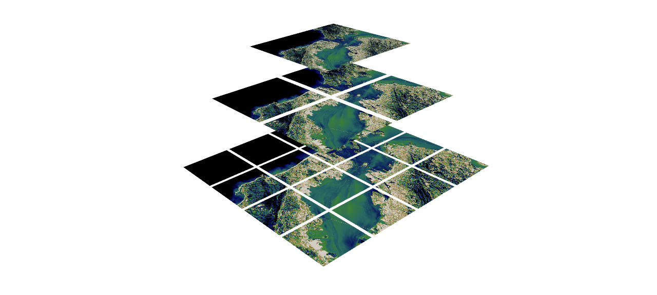
🌐 Local tile server for viewing geospatial raster files with ipyleaflet
🌐 Local Tile Server for Geospatial Rasters Need to visualize a rather large raster (gigabytes) you have locally? This is for you. A Flask application
UNAVOIDS: Unsupervised and Nonparametric Approach for Visualizing Outliers and Invariant Detection Scoring
UNAVOIDS: Unsupervised and Nonparametric Approach for Visualizing Outliers and Invariant Detection Scoring Code Summary aggregate.py: this script aggr

Neural network graphs and training metrics for PyTorch, Tensorflow, and Keras.
HiddenLayer A lightweight library for neural network graphs and training metrics for PyTorch, Tensorflow, and Keras. HiddenLayer is simple, easy to ex

Source code and notebooks to reproduce experiments and benchmarks on Bias Faces in the Wild (BFW).
Face Recognition: Too Bias, or Not Too Bias? Robinson, Joseph P., Gennady Livitz, Yann Henon, Can Qin, Yun Fu, and Samson Timoner. "Face recognition:

Biterm Topic Model (BTM): modeling topics in short texts
Biterm Topic Model Bitermplus implements Biterm topic model for short texts introduced by Xiaohui Yan, Jiafeng Guo, Yanyan Lan, and Xueqi Cheng. Actua

PyExplainer: A Local Rule-Based Model-Agnostic Technique (Explainable AI)
PyExplainer PyExplainer is a local rule-based model-agnostic technique for generating explanations (i.e., why a commit is predicted as defective) of J

An interactive dashboard for visualisation, integration and classification of data using Active Learning.
AstronomicAL An interactive dashboard for visualisation, integration and classification of data using Active Learning. AstronomicAL is a human-in-the-

Neurons Dataset API - The official dataloader and visualization tools for Neurons Datasets.
Neurons Dataset API - The official dataloader and visualization tools for Neurons Datasets. Introduction We propose our dataloader API for loading and
Cryptocurrency Centralized Exchange Visualization
This is a simple one that uses Grafina to visualize cryptocurrency from the Bitkub exchange. This service will make a request to the Bitkub API from your wallet and save the response to Postgresql. Grafina will retrieve data from Postgresql and display the graph.

Visualization of numerical optimization algorithms
Visualization of numerical optimization algorithms

A multi-platform GUI for bit-based analysis, processing, and visualization
A multi-platform GUI for bit-based analysis, processing, and visualization

Render tokei's output to interactive sunburst chart.
Render tokei's output to interactive sunburst chart.

Pebble is a stat's visualization tool, this will provide a skeleton to develop a monitoring tool.
Pebble is a stat's visualization tool, this will provide a skeleton to develop a monitoring tool.

Implementation of the pix2pix model on satellite images
This repo shows how to implement and use the pix2pix GAN model for image to image translation. The model is demonstrated on satellite images, and the

Portfolio analytics for quants, written in Python
QuantStats: Portfolio analytics for quants QuantStats Python library that performs portfolio profiling, allowing quants and portfolio managers to unde

Python package to visualize and cluster partial dependence.
partial_dependence A python library for plotting partial dependence patterns of machine learning classifiers. The technique is a black box approach to

moDel Agnostic Language for Exploration and eXplanation
moDel Agnostic Language for Exploration and eXplanation Overview Unverified black box model is the path to the failure. Opaqueness leads to distrust.

Scientific Visualization: Python + Matplotlib
An open access book on scientific visualization using python and matplotlib
A package to fetch sentinel 2 Satellite data from Google.
Sentinel 2 Data Fetcher Installation Create a Virtual Environment and activate it. python3 -m venv venv . venv/bin/activate Install the Package via pi

Interactive convnet features visualization for Keras
Quiver Interactive convnet features visualization for Keras The quiver workflow Video Demo Build your model in keras model = Model(...) Launch the vis

LEOGPS - Satellite Navigation with GPS on Python!
LEOGPS is an open-source Python software which performs relative satellite navigation between two formation flying satellites, with the objective of high accuracy relative positioning. Specifically, LEOGPS solves for the double-differenced baseline (using float ambiguity resolution) between satellites flying in formation in Low Earth Orbit (LEO).

VizTracer is a low-overhead logging/debugging/profiling tool that can trace and visualize your python code execution.
VizTracer is a low-overhead logging/debugging/profiling tool that can trace and visualize your python code execution.

Pytools is an open source library containing general machine learning and visualisation utilities for reuse
pytools is an open source library containing general machine learning and visualisation utilities for reuse, including: Basic tools for API developmen

Image Segmentation using U-Net, U-Net with skip connections and M-Net architectures
Brain-Image-Segmentation Segmentation of brain tissues in MRI image has a number of applications in diagnosis, surgical planning, and treatment of bra

code for paper -- "Seamless Satellite-image Synthesis"
Seamless Satellite-image Synthesis by Jialin Zhu and Tom Kelly. Project site. The code of our models borrows heavily from the BicycleGAN repository an

Daily social mapping project in November 2021. Maps made using PyGMT whenever possible.
Daily social mapping project in November 2021. Maps made using PyGMT whenever possible.

Python Package for CanvasXpress JS Visualization Tools
CanvasXpress Python Library About CanvasXpress for Python CanvasXpress was developed as the core visualization component for bioinformatics and system
Python tools for working with Orbit Ephemeris Messages (OEMs).
Python Orbit Ephemeris Message tools Python tools for working with Orbit Ephemeris Messages (OEMs). Development Status Installation The oem package is

A simple project on Data Visualization for CSCI-40 course.
Simple-Data-Visualization A simple project on Data Visualization for CSCI-40 course - the instructions can be found here SAT results in New York in 20
ecoglib: visualization and statistics for high density microecog signals
ecoglib: visualization and statistics for high density microecog signals This library contains high-level analysis tools for "topos" and "chronos" asp

Exploratory analysis and data visualization of aircraft accidents and incidents in Brazil.
Exploring aircraft accidents in Brazil Occurrencies with aircraft in Brazil are investigated by the Center for Investigation and Prevention of Aircraf

A Python package to facilitate research on building and evaluating automated scoring models.
Rater Scoring Modeling Tool Introduction Automated scoring of written and spoken test responses is a growing field in educational natural language pro

cLoops2: full stack analysis tool for chromatin interactions
cLoops2: full stack analysis tool for chromatin interactions Introduction cLoops2 is an extension of our previous work, cLoops. From loop-calling base

edaSQL is a library to link SQL to Exploratory Data Analysis and further more in the Data Engineering.
edaSQL is a python library to bridge the SQL with Exploratory Data Analysis where you can connect to the Database and insert the queries. The query results can be passed to the EDA tool which can give greater insights to the user.

Convolutional neural network visualization techniques implemented in PyTorch.
This repository contains a number of convolutional neural network visualization techniques implemented in PyTorch.
A method to perform unsupervised cross-region adaptation of crop classifiers trained with satellite image time series.
TimeMatch Official source code of TimeMatch: Unsupervised Cross-region Adaptation by Temporal Shift Estimation by Joachim Nyborg, Charlotte Pelletier,

A diff tool for language models
LMdiff Qualitative comparison of large language models. Demo & Paper: http://lmdiff.net LMdiff is a MIT-IBM Watson AI Lab collaboration between: Hendr

MPL Plotter is a Matplotlib based Python plotting library built with the goal of delivering publication-quality plots concisely.
MPL Plotter is a Matplotlib based Python plotting library built with the goal of delivering publication-quality plots concisely.

A python module for scientific analysis of 3D objects based on VTK and Numpy
A lightweight and powerful python module for scientific analysis and visualization of 3d objects.

Visualization Data Drug in thailand during 2014 to 2020
Visualization Data Drug in thailand during 2014 to 2020 Data sorce from ข้อมูลเปิดภาครัฐ สำนักงาน ป.ป.ส Inttroducing program Using tkinter module for

The Metabolomics Integrator (MINT) is a post-processing tool for liquid chromatography-mass spectrometry (LCMS) based metabolomics.
MINT (Metabolomics Integrator) The Metabolomics Integrator (MINT) is a post-processing tool for liquid chromatography-mass spectrometry (LCMS) based m

Data science, Data manipulation and Machine learning package.
duality Data science, Data manipulation and Machine learning package. Use permitted according to the terms of use and conditions set by the attached l

This is an auto-ML tool specialized in detecting of outliers
Auto-ML tool specialized in detecting of outliers Description This tool will allows you, with a Dash visualization, to compare 10 models of machine le

Decision Border Visualizer for Classification Algorithms
dbv Decision Border Visualizer for Classification Algorithms Project description A python package for Machine Learning Engineers who want to visualize

A command line tool for visualizing CSV/spreadsheet-like data
PerfPlotter Read data from CSV files using pandas and generate interactive plots using bokeh, which can then be embedded into HTML pages and served by
Data visualization electromagnetic spectrum
Datenvisualisierung-Elektromagnetischen-Spektrum Anhand des Moduls matplotlib sollen die Daten des elektromagnetischen Spektrums dargestellt werden. D

Homework 2: Matplotlib and Data Visualization
Homework 2: Matplotlib and Data Visualization Overview These data visualizations were created for my introductory computer science course using Python
Multiband spectro-radiometric satellite image analysis with K-means cluster algorithm
Multi-band Spectro Radiomertric Image Analysis with K-means Cluster Algorithm Overview Multi-band Spectro Radiomertric images are images comprising of

Can we visualize a large scientific data set with a surrogate model? We're building a GAN for the Earth's Mantle Convection data set to see if we can!
EarthGAN - Earth Mantle Surrogate Modeling Can a surrogate model of the Earth’s Mantle Convection data set be built such that it can be readily run in

Data visualization using matplotlib
Data visualization using matplotlib project instructions Top 5 Most Common Coffee Origins In this visualization I used data from Ankur Chavda on Kaggl

Rick and Morty Data Visualization with python
Rick and Morty Data Visualization For this project I looked at data for the TV show Rick and Morty Number of Episodes at a Certain Location Here is th

Create a visualization for Trump's Tweeted Words Using Python
Data Trump's Tweeted Words This plot illustrates twitter word occurences. We already did the coding I needed for this plot, so I was very inspired to

China and India Population and GDP Visualization
China and India Population and GDP Visualization Historical Population Comparison between India and China This graph shows the population data of Indi
Python IDE or notebook to generate a basic Kepler.gl data visualization
geospatial-data-analysis [readme] Use this code in your Python IDE or notebook to generate a basic Kepler.gl data visualization, without pre-configura
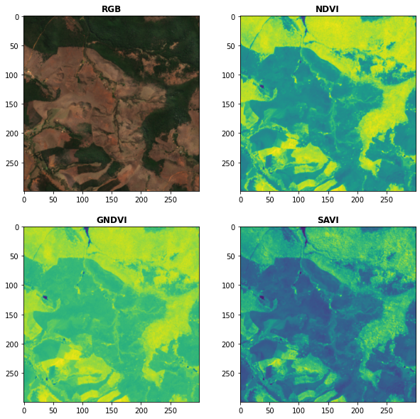
Awesome Spectral Indices in Python.
Awesome Spectral Indices in Python: Numpy | Pandas | GeoPandas | Xarray | Earth Engine | Planetary Computer | Dask GitHub: https://github.com/davemlz/
This is a web application to visualize various famous technical indicators and stocks tickers from user
Visualizing Technical Indicators Using Python and Plotly. Currently facing issues hosting the application on heroku. As soon as I am able to I'll like

Automatic picture transmission(APT) protocol decoder for NOAA weather satellites
Automatic picture transmission(APT) decoder Automatic picture transmission protocol is used by NOAA satellites. They constantly send a frequency modul

A simple python script that, given a location and a date, uses the Nasa Earth API to show a photo taken by the Landsat 8 satellite. The script must be executed on the command-line.
What does it do? Given a location and a date, it uses the Nasa Earth API to show a photo taken by the Landsat 8 satellite. The script must be executed

LibreMind is a free meditation app made in under 24 hours. It has various meditation, breathwork, and visualization exercises.
libreMind Meditation exercises What is it? LibreMind is a free meditation app made in under 24 hours. It has various meditation, breathwork, and visua
3D detection and tracking viewer (visualization) for kitti & waymo dataset
3D detection and tracking viewer (visualization) for kitti & waymo dataset

Build, deploy and extract satellite public constellations with one command line.
SatExtractor Build, deploy and extract satellite public constellations with one command line. Table of Contents About The Project Getting Started Stru
This is a sorting visualizer made with Tkinter.
Sorting-Visualizer This is a sorting visualizer made with Tkinter. Make sure you've installed tkinter in your system to use this visualizer pip instal

JittorVis - Visual understanding of deep learning models
JittorVis: Visual understanding of deep learning model JittorVis is an open-source library for understanding the inner workings of Jittor models by vi
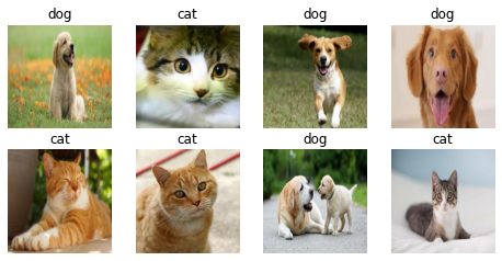
A multi-functional library for full-stack Deep Learning. Simplifies Model Building, API development, and Model Deployment.
chitra What is chitra? chitra (चित्र) is a multi-functional library for full-stack Deep Learning. It simplifies Model Building, API development, and M
A simple example of ML classification, cross validation, and visualization of feature importances
Simple-Classifier This is a basic example of how to use several different libraries for classification and ensembling, mostly with sklearn. Example as

QuakeLabeler is a Python package to create and manage your seismic training data, processes, and visualization in a single place — so you can focus on building the next big thing.
QuakeLabeler Quake Labeler was born from the need for seismologists and developers who are not AI specialists to easily, quickly, and independently bu

Retentioneering: product analytics, data-driven customer journey map optimization, marketing analytics, web analytics, transaction analytics, graph visualization, and behavioral segmentation with customer segments in Python.
What is Retentioneering? Retentioneering is a Python framework and library to assist product analysts and marketing analysts as it makes it easier to

Seaborn-image is a Python image visualization library based on matplotlib and provides a high-level API to draw attractive and informative images quickly and effectively.
seaborn-image: image data visualization Description Seaborn-image is a Python image visualization library based on matplotlib and provides a high-leve

Doosan robotic arm, simulation, control, visualization in Gazebo and ROS2 for Reinforcement Learning.
Robotic Arm Simulation in ROS2 and Gazebo General Overview This repository includes: First, how to simulate a 6DoF Robotic Arm from scratch using GAZE
EODAG is a command line tool and a plugin-oriented Python framework for searching, aggregating results and downloading remote sensed images while offering a unified API for data access regardless of the data provider
EODAG (Earth Observation Data Access Gateway) is a command line tool and a plugin-oriented Python framework for searching, aggregating results and downloading remote sensed images while offering a unified API for data access regardless of the data provider

Amazon Forest Computer Vision: Satellite Image tagging code using PyTorch / Keras with lots of PyTorch tricks
Amazon Forest Computer Vision Satellite Image tagging code using PyTorch / Keras Here is a sample of images we had to work with Source: https://www.ka
missing-pixel-filler is a python package that, given images that may contain missing data regions (like satellite imagery with swath gaps), returns these images with the regions filled.
Missing Pixel Filler This is the official code repository for the Missing Pixel Filler by SpaceML. missing-pixel-filler is a python package that, give

A GUI visualization of QuickSort algorithm
QQuickSort A simple GUI visualization of QuickSort algorithm. It only uses PySide6, it does not have any other external dependency. How to run Install

PoseViz – Multi-person, multi-camera 3D human pose visualization tool built using Mayavi.
PoseViz – 3D Human Pose Visualizer Multi-person, multi-camera 3D human pose visualization tool built using Mayavi. As used in MeTRAbs visualizations.

Glue is a python project to link visualizations of scientific datasets across many files.
Glue Glue is a python project to link visualizations of scientific datasets across many files. Click on the image for a quick demo: Features Interacti
🌌 Economics Observatory Visualisation Repository
Economics Observatory Visualisation Repository Website | Visualisations | Data | Here you will find all the data visualisations and infographics attac

A gui application to visualize various sorting algorithms using pure python.
Sorting Algorithm Visualizer A gui application to visualize various sorting algorithms using pure python. Language : Python 3 Libraries required Tkint
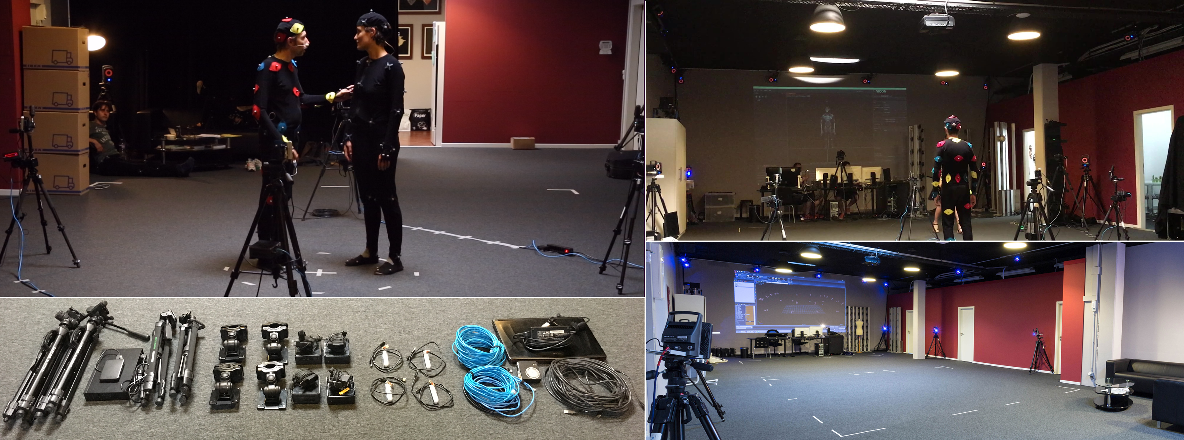
Human4D Dataset tools for processing and visualization
HUMAN4D: A Human-Centric Multimodal Dataset for Motions & Immersive Media HUMAN4D constitutes a large and multimodal 4D dataset that contains a variet
A data visualization curriculum of interactive notebooks.
A data visualization curriculum of interactive notebooks, using Vega-Lite and Altair. This repository contains a series of Python-based Jupyter notebooks.

A visualization tool made in Pygame for various pathfinding algorithms.
Pathfinding-Visualizer 🚀 A visualization tool made in Pygame for various pathfinding algorithms. Pathfinding is closely related to the shortest path

Using Selenium with Python to Web Scrap Popular Youtube Tech Channels.
Web Scrapping Popular Youtube Tech Channels with Selenium Data Mining, Data Wrangling, and Exploratory Data Analysis About the Data Web scrapi
HyperSpy is an open source Python library for the interactive analysis of multidimensional datasets
HyperSpy is an open source Python library for the interactive analysis of multidimensional datasets that can be described as multidimensional arrays o

Pytorch implementation for our ICCV 2021 paper "TRAR: Routing the Attention Spans in Transformers for Visual Question Answering".
TRAnsformer Routing Networks (TRAR) This is an official implementation for ICCV 2021 paper "TRAR: Routing the Attention Spans in Transformers for Visu
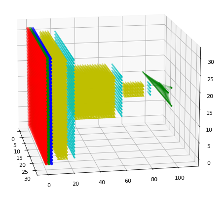
A ultra-lightweight 3D renderer of the Tensorflow/Keras neural network architectures
A ultra-lightweight 3D renderer of the Tensorflow/Keras neural network architectures

Reporting and Visualization for Hazardous Events
Reporting and Visualization for Hazardous Events
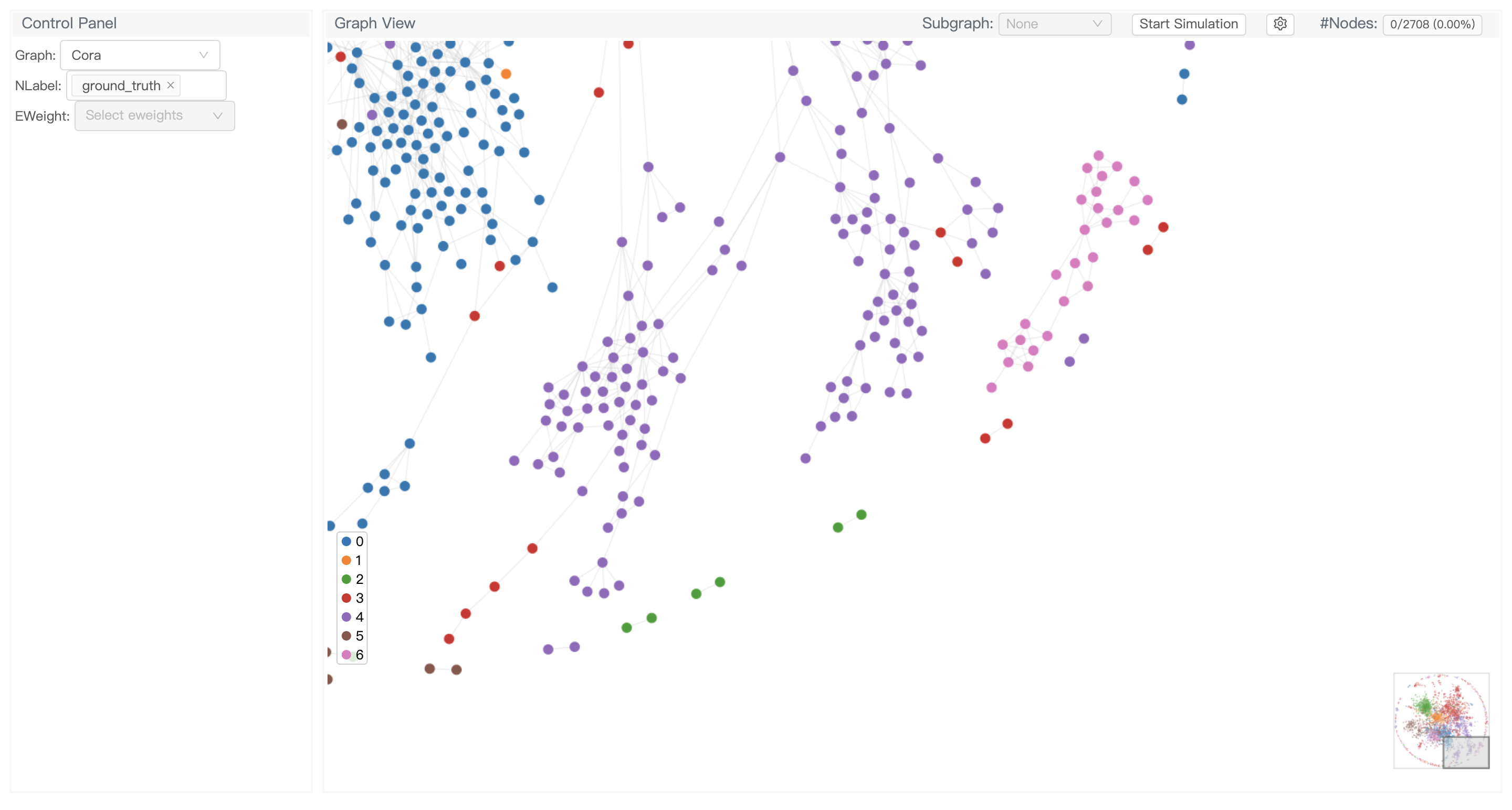
GNNLens2 is an interactive visualization tool for graph neural networks (GNN).
GNNLens2 is an interactive visualization tool for graph neural networks (GNN).
Blender addon to generate better building models from satellite imagery.
Blender addon to generate better building models from satellite imagery.

Interactive Terraform visualization. State and configuration explorer.
Rover - Terraform Visualizer Rover is a Terraform visualizer. In order to do this, Rover: generates a plan file and parses the configuration in the ro

Satellite labelling tool for manual labelling of storm top features such as overshooting tops, above-anvil plumes, cold U/Vs, rings etc.
Satellite labelling tool About this app A tool for manual labelling of storm top features such as overshooting tops, above-anvil plumes, cold U/Vs, ri
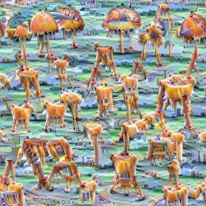
Quickly and easily create / train a custom DeepDream model
Dream-Creator This project aims to simplify the process of creating a custom DeepDream model by using pretrained GoogleNet models and custom image dat

Visualization toolkit for neural networks in PyTorch! Demo --
FlashTorch A Python visualization toolkit, built with PyTorch, for neural networks in PyTorch. Neural networks are often described as "black box". The

PyTorch implementation of DeepDream algorithm
neural-dream This is a PyTorch implementation of DeepDream. The code is based on neural-style-pt. Here we DeepDream a photograph of the Golden Gate Br

Pytorch implementation of convolutional neural network visualization techniques
Convolutional Neural Network Visualizations This repository contains a number of convolutional neural network visualization techniques implemented in

A python toolbox for predictive uncertainty quantification, calibration, metrics, and visualization
Website, Tutorials, and Docs Uncertainty Toolbox A python toolbox for predictive uncertainty quantification, calibration, metrics, and visualizatio
Simple spectra visualization tool for astronomers
SpecViewer A simple visualization tool for astronomers. Dependencies Python = 3.7.4 PyQt5 = 5.15.4 pyqtgraph == 0.10.0 numpy = 1.19.4 How to use py

A Structured Self-attentive Sentence Embedding
Structured Self-attentive sentence embeddings Implementation for the paper A Structured Self-Attentive Sentence Embedding, which was published in ICLR
Train a deep learning net with OpenStreetMap features and satellite imagery.
DeepOSM Classify roads and features in satellite imagery, by training neural networks with OpenStreetMap (OSM) data. DeepOSM can: Download a chunk of
